MyTopo
Glenwood Washington US Topo Map
Couldn't load pickup availability
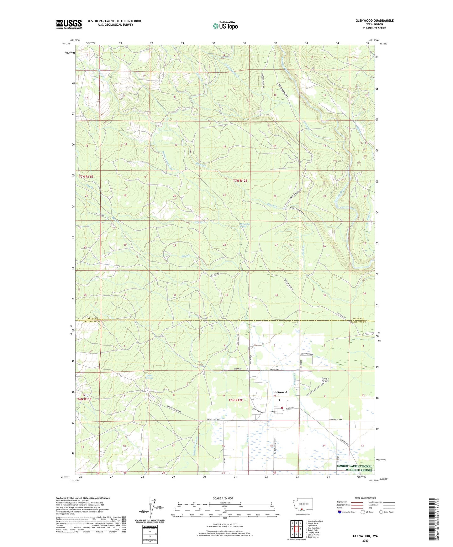
2023 topographic map quadrangle Glenwood in the state of Washington. Scale: 1:24000. Based on the newly updated USGS 7.5' US Topo map series, this map is in the following counties: Yakima, Klickitat. The map contains contour data, water features, and other items you are used to seeing on USGS maps, but also has updated roads and other features. This is the next generation of topographic maps. Printed on high-quality waterproof paper with UV fade-resistant inks.
Quads adjacent to this one:
West: King Mountain
Northwest: Mount Adams East
North: Jungle Butte
Northeast: Signal Peak
East: Outlet Falls
Southeast: Dead Canyon
South: Camas Prairie
Southwest: Quigley Butte
This map covers the same area as the classic USGS quad with code o46121a3.
Contains the following named places: Bacon Creek, Big Muddy Creek, Bird Creek Campground, Blue Jay Campground, Dairy Creek, Draper Springs, Draper Springs Camp, Dry Creek, Flying L Airport, Flying L Ranch Airport, Glenwood, Glenwood Census Designated Place, Glenwood Fire Protection District 8, Glenwood High and Elementary School, Glenwood Post Office, McCumber Spring, North Fork Dairy Creek, Parrott Crossing, Sage Flat Ditch, Stout Campground