MyTopo
Camas Prairie Washington US Topo Map
Couldn't load pickup availability
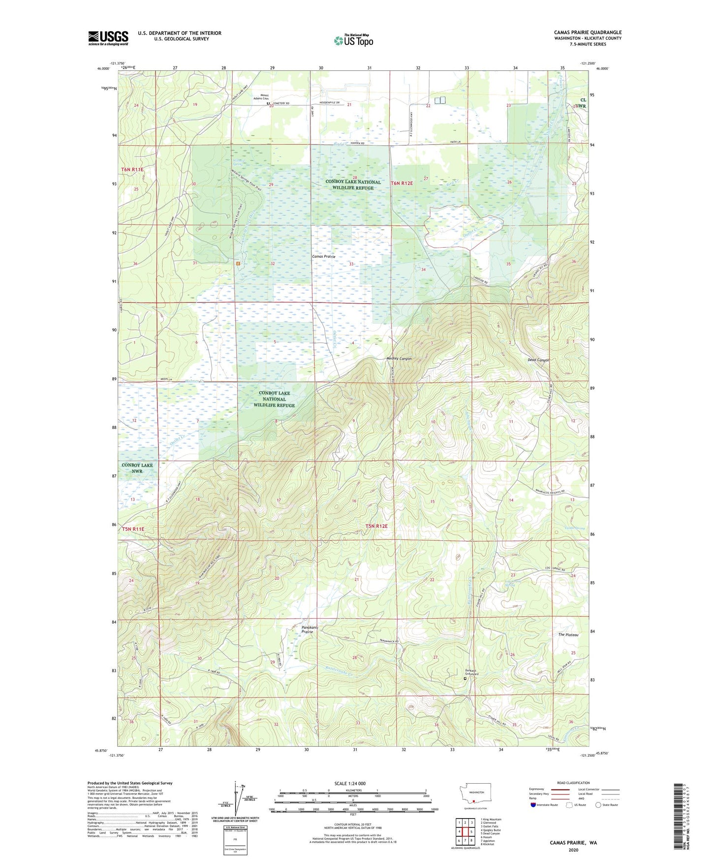
2023 topographic map quadrangle Camas Prairie in the state of Washington. Scale: 1:24000. Based on the newly updated USGS 7.5' US Topo map series, this map is in the following counties: Klickitat. The map contains contour data, water features, and other items you are used to seeing on USGS maps, but also has updated roads and other features. This is the next generation of topographic maps. Printed on high-quality waterproof paper with UV fade-resistant inks.
Quads adjacent to this one:
West: Quigley Butte
Northwest: King Mountain
North: Glenwood
Northeast: Outlet Falls
East: Dead Canyon
Southeast: Klickitat
South: Appleton
Southwest: Husum
This map covers the same area as the classic USGS quad with code o45121h3.
Contains the following named places: Bird Creek, Camas Prairie, Castle Spring, Chapman Creek, Cold Springs Ditch, Conboy Lake, Conboy Lake National Wildlife Refuge, Diamond Gap Lookout, Dunkard Graveyard, Frasier Creek, Holmes Creek, Jebe Swale, Liberty Bond, Log Corral Spring, Medley Canyon, Mount Adams Cemetery, Panakanic, Panakanic Prairie, Panakanic Water Works Dam, Whitcomb Cabin, Willard Spring, ZIP Code: 98619