
MyTopo
Packwood Washington US Topo Map
Couldn't load pickup availability
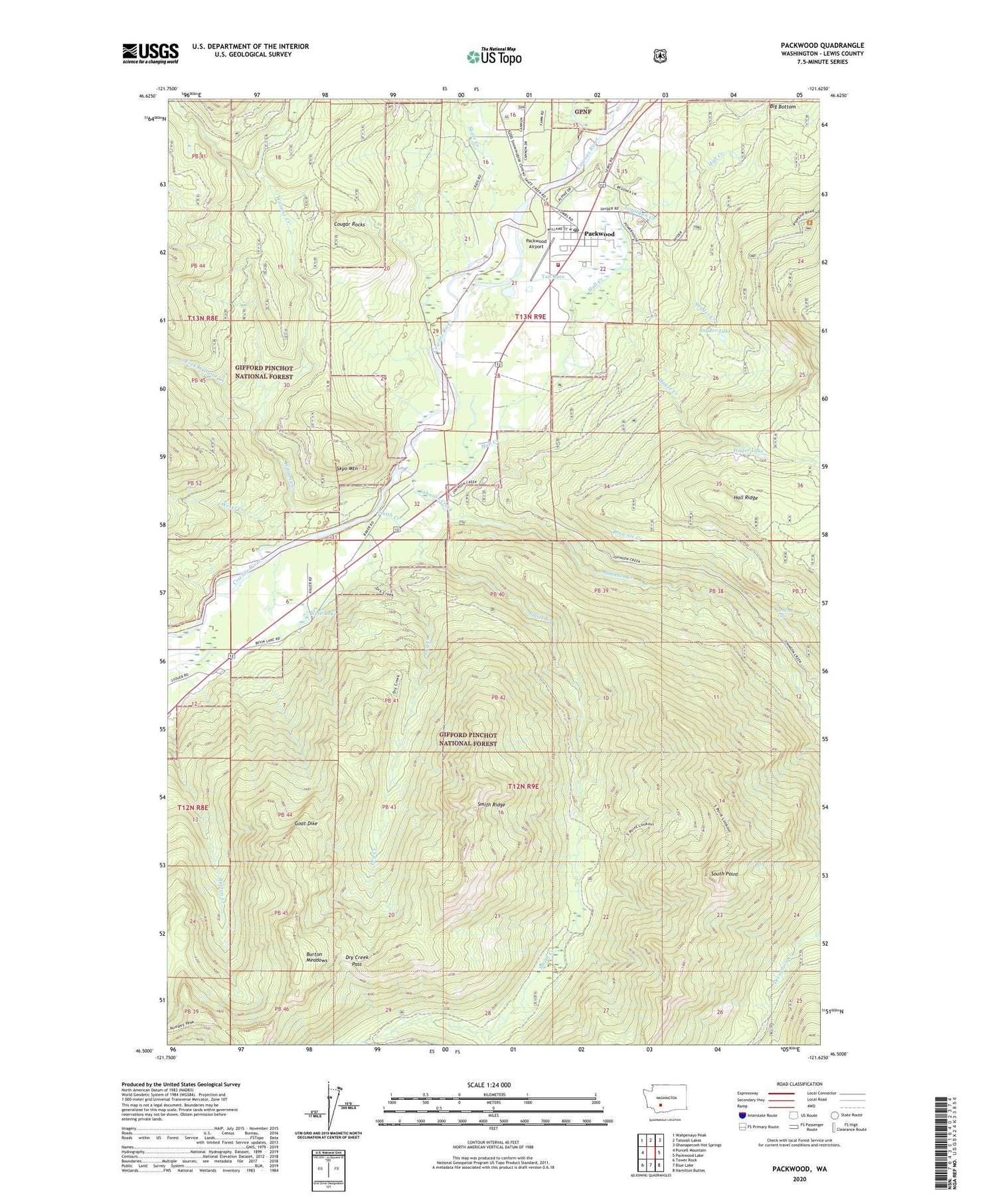
2020 topographic map quadrangle Packwood in the state of Washington. Scale: 1:24000. Based on the newly updated USGS 7.5' US Topo map series, this map is in the following counties: Lewis. The map contains contour data, water features, and other items you are used to seeing on USGS maps, but also has updated roads and other features. This is the next generation of topographic maps. Printed on high-quality waterproof paper with UV fade-resistant inks.
Quads adjacent to this one:
West: Purcell Mountain
Northwest: Wahpenayo Peak
North: Tatoosh Lakes
Northeast: Ohanapecosh Hot Springs
East: Packwood Lake
Southeast: Hamilton Buttes
South: Blue Lake
Southwest: Tower Rock
Contains the following named places: Big Bottom Division, Bivin Lake, Brownie Creek, Burton Meadows, Cougar Rocks, Dry Creek, Dry Creek Lookout, Dry Creek Lookout Tower, Dry Creek Pass, Dry Creek Trail, Goat Dike, Hager Creek, Hager Lake, Hall Creek, Jennings Falls, Johnson Creek, Jonathan Creek, Lewis County Fire District 10 Station 1, Lewis County Fire District 10 Station 3, Packwood, Packwood Airport, Packwood Census Designated Place, Packwood Elementary School, Packwood Post Office, Packwood Ranger Station, Pompey Peak Trail, Skate Creek, Skyo Mountain, Smith Creek, Smith Ridge, Snyder Creek, Snyder Lake, South Fork Willame Creek, South Point, South Point Lookout, South Point Trail, Tail Race, Wesel Creek, Willame Creek, Zone I Engineering Station


