MyTopo
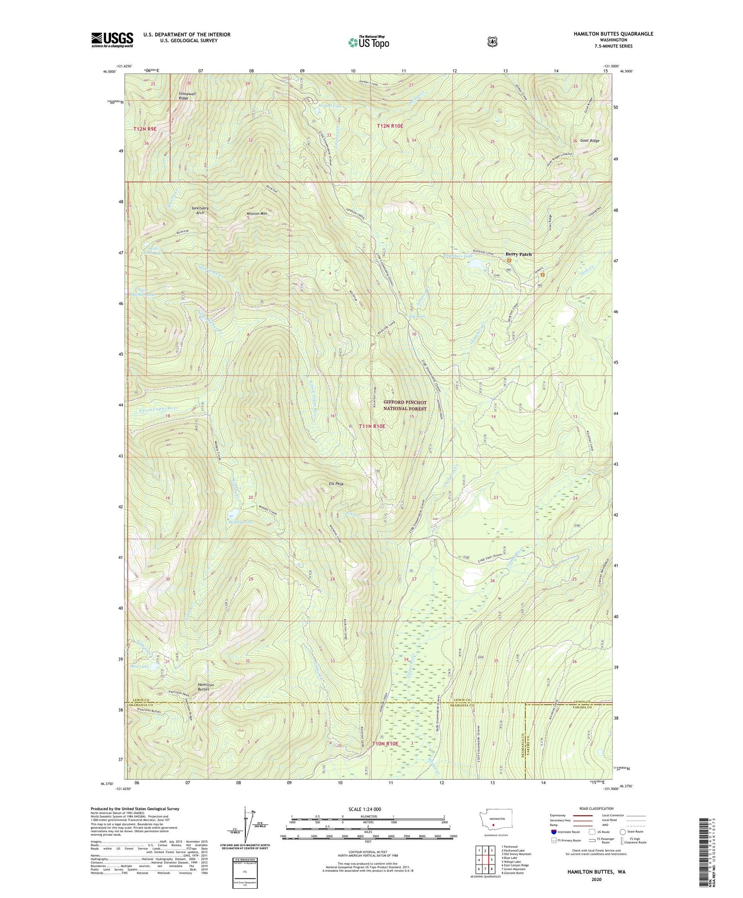
Hamilton Buttes Washington US Topo Map
Couldn't load pickup availability
Also explore the Hamilton Buttes Forest Service Topo of this same quad for updated USFS data
2023 topographic map quadrangle Hamilton Buttes in the state of Washington. Scale: 1:24000. Based on the newly updated USGS 7.5' US Topo map series, this map is in the following counties: Lewis, Skamania, Yakima. The map contains contour data, water features, and other items you are used to seeing on USGS maps, but also has updated roads and other features. This is the next generation of topographic maps. Printed on high-quality waterproof paper with UV fade-resistant inks.
Quads adjacent to this one:
West: Blue Lake
Northwest: Packwood
North: Packwood Lake
Northeast: Old Snowy Mountain
East: Walupt Lake
Southeast: Glaciate Butte
South: Green Mountain
Southwest: East Canyon Ridge
This map covers the same area as the classic USGS quad with code o46121d5.
Contains the following named places: Berry Patch, Chambers Lake, Chambers Lake Campground, Cispus River, Elk Creek, Elk Peak, Goat Creek, Goat Ridge Lookout, Hamilton Buttes, Hugo Lake, Jordan Creek, Mission Mountain, Mud Lake, Saint John Creek, Saint John Lake, Saint Michael Creek, Sanctuary Arch, Stonewall Ridge, Wesley Creek, Wobbly Creek, Wobbly Lake, Wright Lake