MyTopo
Blue Lake Washington US Topo Map
Couldn't load pickup availability
Also explore the Blue Lake Forest Service Topo of this same quad for updated USFS data
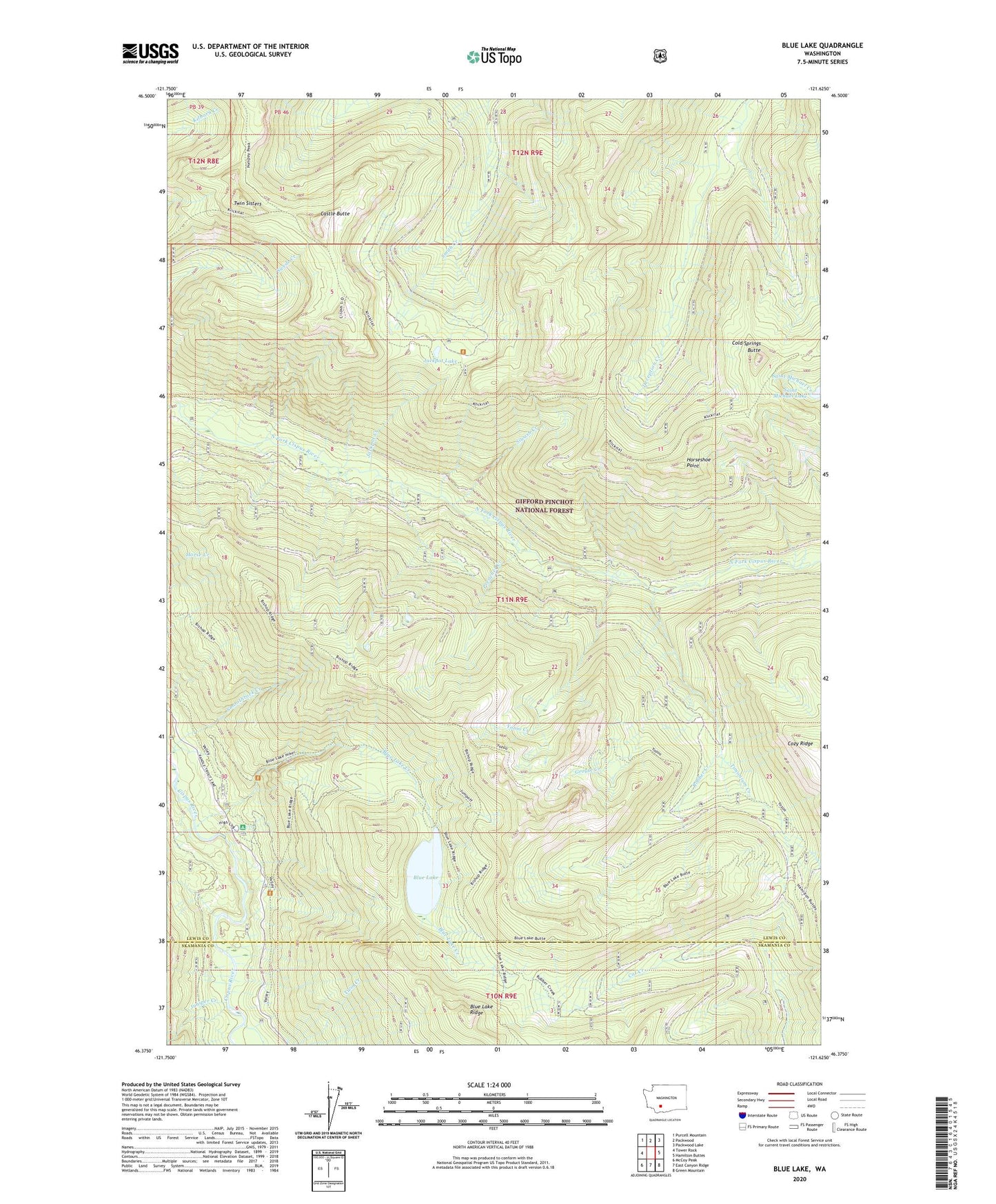
2023 topographic map quadrangle Blue Lake in the state of Washington. Scale: 1:24000. Based on the newly updated USGS 7.5' US Topo map series, this map is in the following counties: Lewis, Skamania. The map contains contour data, water features, and other items you are used to seeing on USGS maps, but also has updated roads and other features. This is the next generation of topographic maps. Printed on high-quality waterproof paper with UV fade-resistant inks.
Quads adjacent to this one:
West: Tower Rock
Northwest: Purcell Mountain
North: Packwood
Northeast: Packwood Lake
East: Hamilton Buttes
Southeast: Green Mountain
South: East Canyon Ridge
Southwest: McCoy Peak
This map covers the same area as the classic USGS quad with code o46121d6.
Contains the following named places: Blue Lake, Blue Lake Camp Picnic Area, Blue Lake Creek, Blue Lake Creek Campground, Blue Lake Ridge, Castle Butte, Cold Springs Butte, Cozy Ridge, Grouse Creek, Horseshoe Point, Jackpot Creek, Jackpot Lake, Juniper Creek, Klickitat Trail, Preacher Creek, Robber Creek, Saint Michael Lake, Siwash Creek, Timonium Creek, Twin Creek, Twin Sisters, Yozoo Creek