MyTopo
Pateros Washington US Topo Map
Couldn't load pickup availability
Also explore the Pateros Forest Service Topo of this same quad for updated USFS data
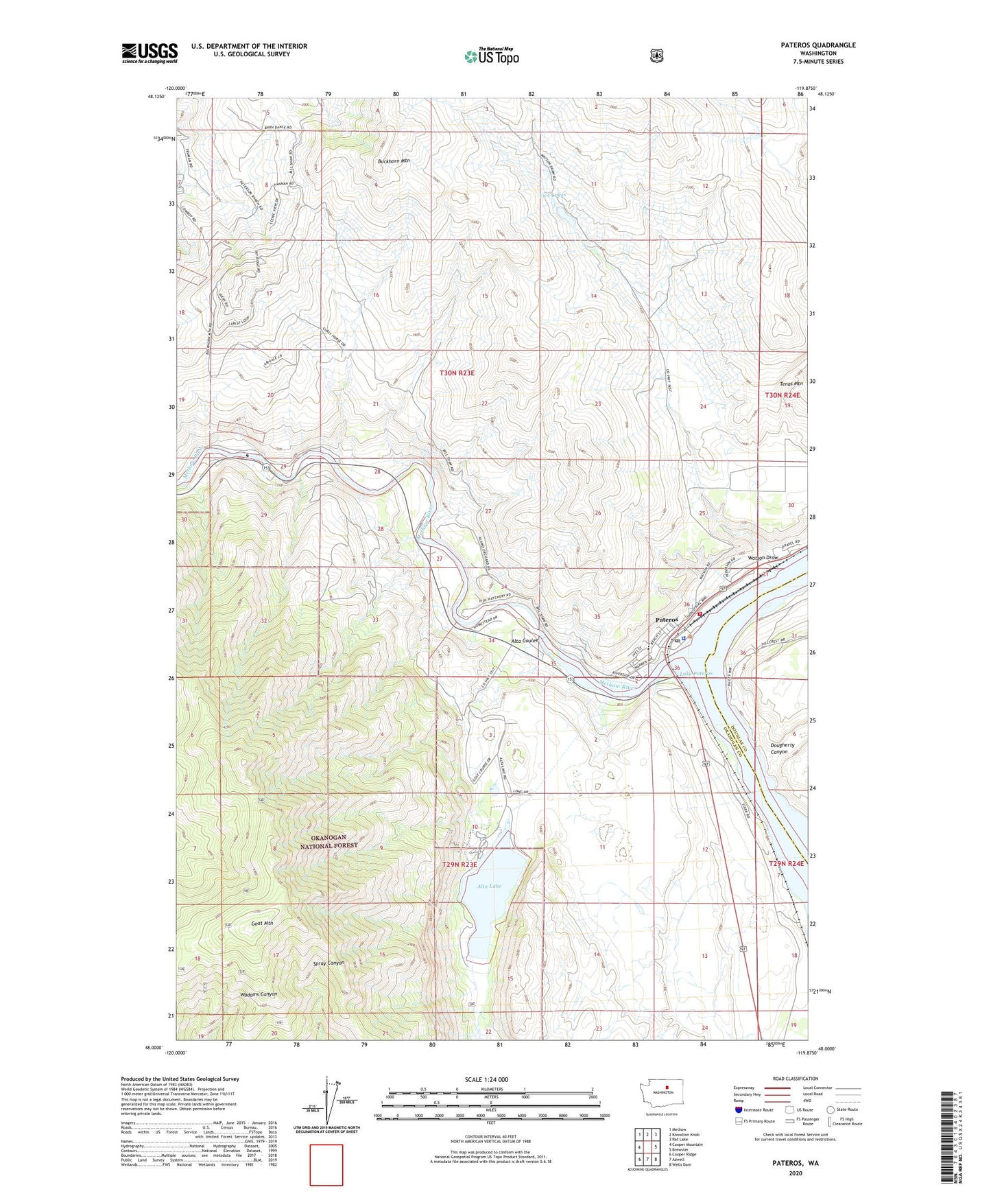
2023 topographic map quadrangle Pateros in the state of Washington. Scale: 1:24000. Based on the newly updated USGS 7.5' US Topo map series, this map is in the following counties: Okanogan, Douglas. The map contains contour data, water features, and other items you are used to seeing on USGS maps, but also has updated roads and other features. This is the next generation of topographic maps. Printed on high-quality waterproof paper with UV fade-resistant inks.
Quads adjacent to this one:
West: Cooper Mountain
Northwest: Methow
North: Knowlton Knob
Northeast: Rat Lake
East: Brewster
Southeast: Wells Dam
South: Azwell
Southwest: Cooper Ridge
This map covers the same area as the classic USGS quad with code o48119a8.
Contains the following named places: Alta Coulee, Alta Lake, Alta Lake Golf Course, Alta Lake State Park, City of Pateros, Dougherty Canyon, Douglas - Okanogan County Fire District 15 Pateros Station 10, Goat Mountain, Methow Rapids, Methow River, Okanogan County Sheriff Pateros, Pateros, Pateros Elementary School, Pateros High School, Pateros Post Office, Pateros United Methodist Church, Pateros Volunteer Fire Department, Watson Draw, ZIP Code: 98846