MyTopo
Peshastin Washington US Topo Map
Couldn't load pickup availability
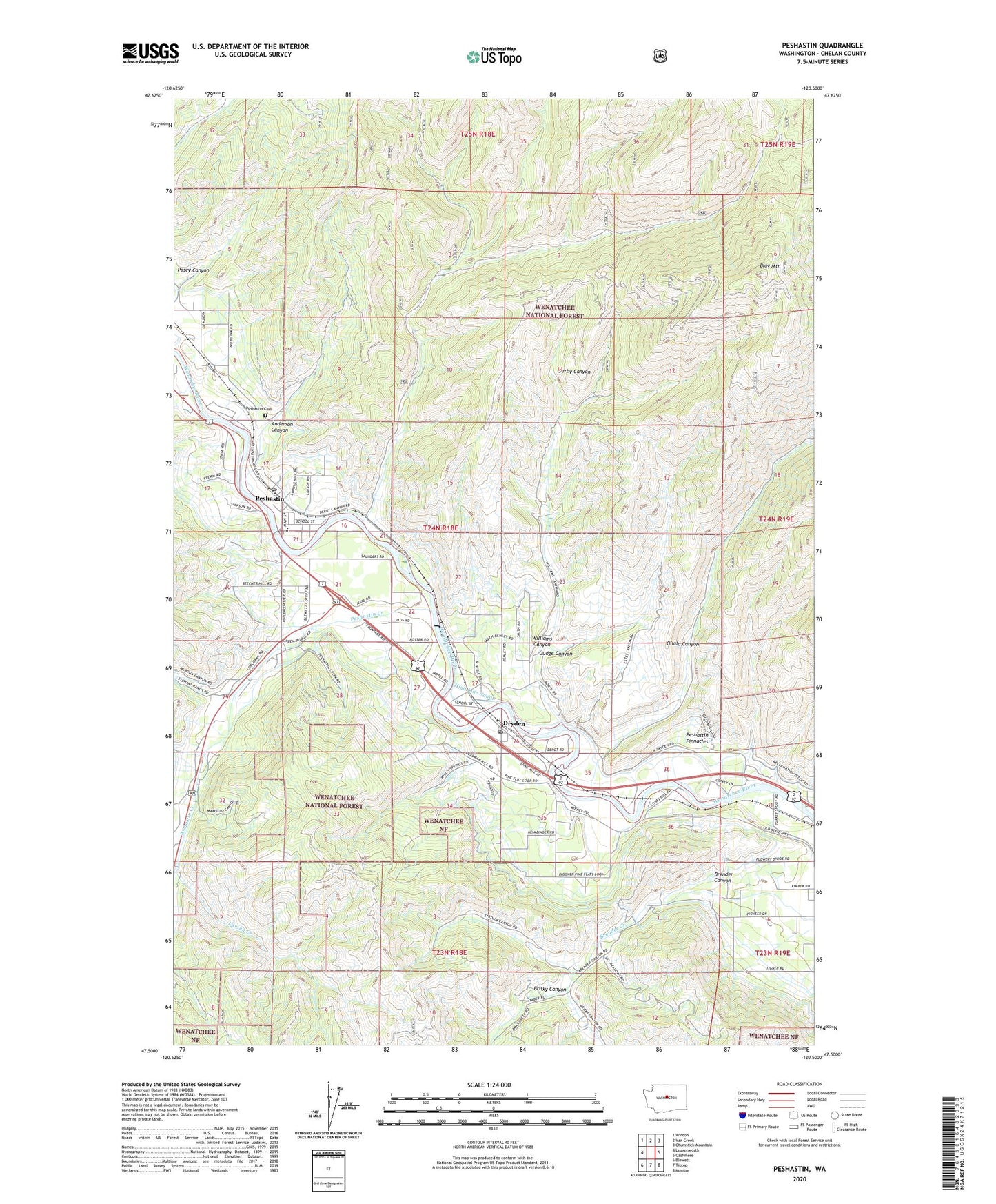
2020 topographic map quadrangle Peshastin in the state of Washington. Scale: 1:24000. Based on the newly updated USGS 7.5' US Topo map series, this map is in the following counties: Chelan. The map contains contour data, water features, and other items you are used to seeing on USGS maps, but also has updated roads and other features. This is the next generation of topographic maps. Printed on high-quality waterproof paper with UV fade-resistant inks.
Quads adjacent to this one:
West: Leavenworth
Northwest: Winton
North: Van Creek
Northeast: Chumstick Mountain
East: Cashmere
Southeast: Monitor
South: Tiptop
Southwest: Blewett
Contains the following named places: Anderson Canyon, Blag Mountain, Brender Canyon, Brisky Canyon, C and D Orchards, Dawn Lee Mobile Home Court, Derby Canyon, Dryden, Dryden Community Church, Dryden Diversion Dam, Dryden Post Office, High Line Canal, Judge Canyon, KZPH-FM (Cashmere), Larsen Creek, Leavenworth Christian Fellowship Church, Ollala Canyon, Peshastin, Peshastin Assembly of God Church, Peshastin Cemetery, Peshastin Creek, Peshastin Ditch, Peshastin Dryden Elementary School, Peshastin Pinnacles, Peshastin Post Office, Peshastin United Church of Christ, Riverbend Mobile Home Park, Williams Canyon, ZIP Code: 98821