MyTopo
Chumstick Mountain Washington US Topo Map
Couldn't load pickup availability
Also explore the Chumstick Mountain Forest Service Topo of this same quad for updated USFS data
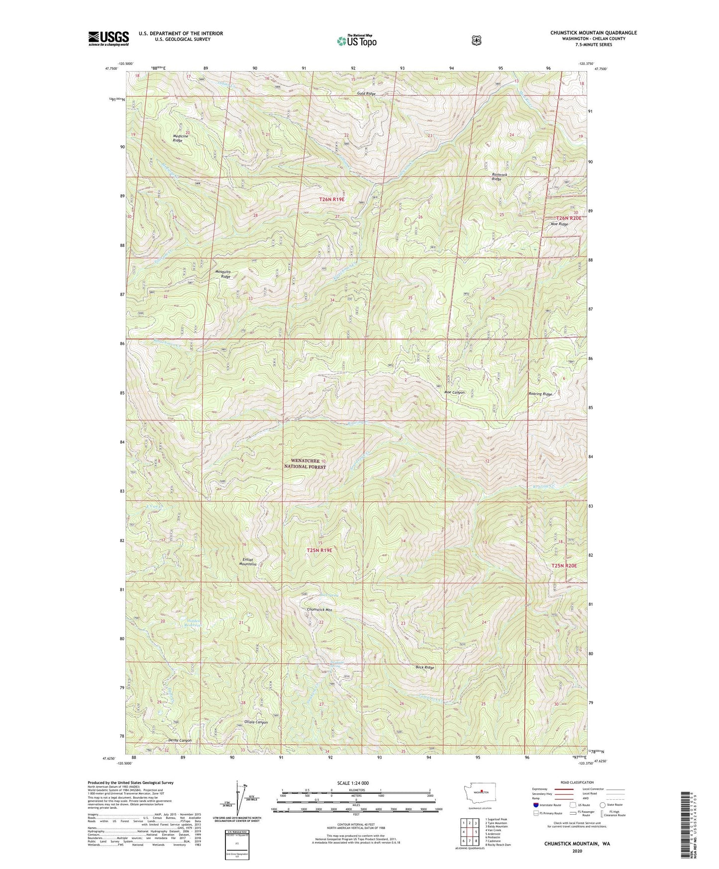
2023 topographic map quadrangle Chumstick Mountain in the state of Washington. Scale: 1:24000. Based on the newly updated USGS 7.5' US Topo map series, this map is in the following counties: Chelan. The map contains contour data, water features, and other items you are used to seeing on USGS maps, but also has updated roads and other features. This is the next generation of topographic maps. Printed on high-quality waterproof paper with UV fade-resistant inks.
Quads adjacent to this one:
West: Van Creek
Northwest: Sugarloaf Peak
North: Tyee Mountain
Northeast: Baldy Mountain
East: Ardenvoir
Southeast: Rocky Reach Dam
South: Cashmere
Southwest: Peshastin
This map covers the same area as the classic USGS quad with code o47120f4.
Contains the following named places: Buck Ridge, Buck Spring, Chumstick Mountain, Hidden Reservoir, Indian Creek, Kloochman Creek, Medicine Creek, Moe Ridge, Mosquito Ridge, Roaring Ridge, Rothrock Ridge, Sourdough Creek, Swakane Spring, Tamarack Creek, Tillicum Creek, ZIP Code: 98811