MyTopo
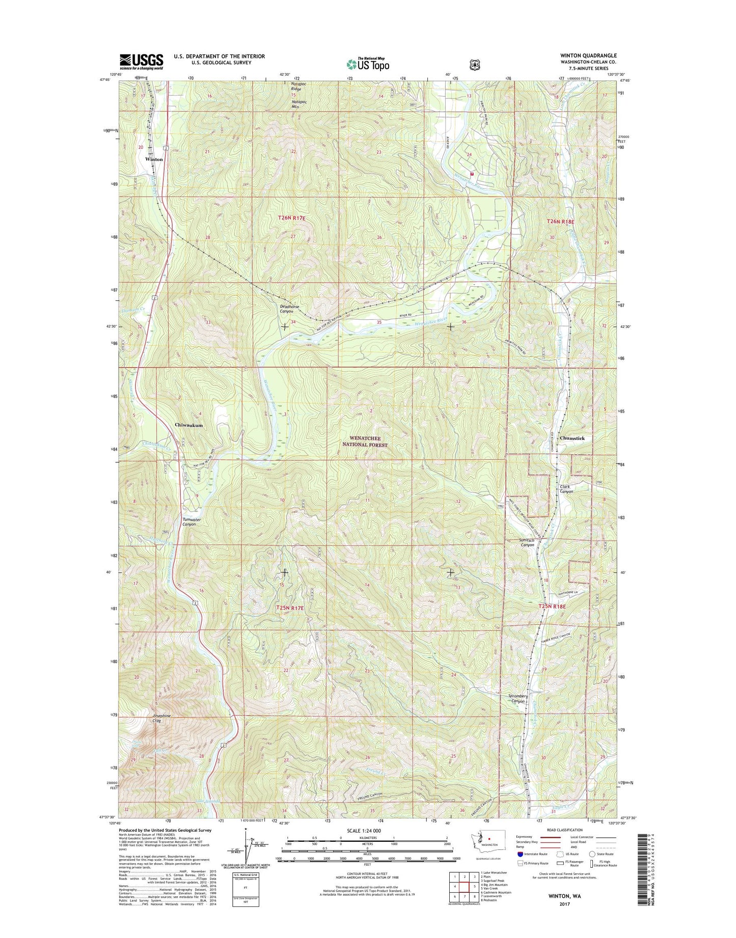
Winton Washington US Topo Map
Couldn't load pickup availability
Also explore the Winton Forest Service Topo of this same quad for updated USFS data
2023 topographic map quadrangle Winton in the state of Washington. Scale: 1:24000. Based on the newly updated USGS 7.5' US Topo map series, this map is in the following counties: Chelan. The map contains contour data, water features, and other items you are used to seeing on USGS maps, but also has updated roads and other features. This is the next generation of topographic maps. Printed on high-quality waterproof paper with UV fade-resistant inks.
Quads adjacent to this one:
West: Big Jim Mountain
Northwest: Lake Wenatchee
North: Plain
Northeast: Sugarloaf Peak
East: Van Creek
Southeast: Peshastin
South: Leavenworth
Southwest: Cashmere Mountain
This map covers the same area as the classic USGS quad with code o47120f6.
Contains the following named places: Cabin Creek, Chelan County Fire District 4, Chiwaukum, Chiwaukum Creek, Chumstick, Clark Canyon, Deadhorse Canyon, Drury Falls, Fall Creek, Freund Creek, Hatchery Creek, Josephine Crag, Little Chumstick Creek, Natapoc Mountain, Natapoc Ridge, Skinney Creek, Spromberg Canyon, Sunitsch Canyon, Swift Water Picnic Area, Thomson Creek, Tumwater Campground, Winton, Winton Elementary School