MyTopo
Pluvius Washington US Topo Map
Couldn't load pickup availability
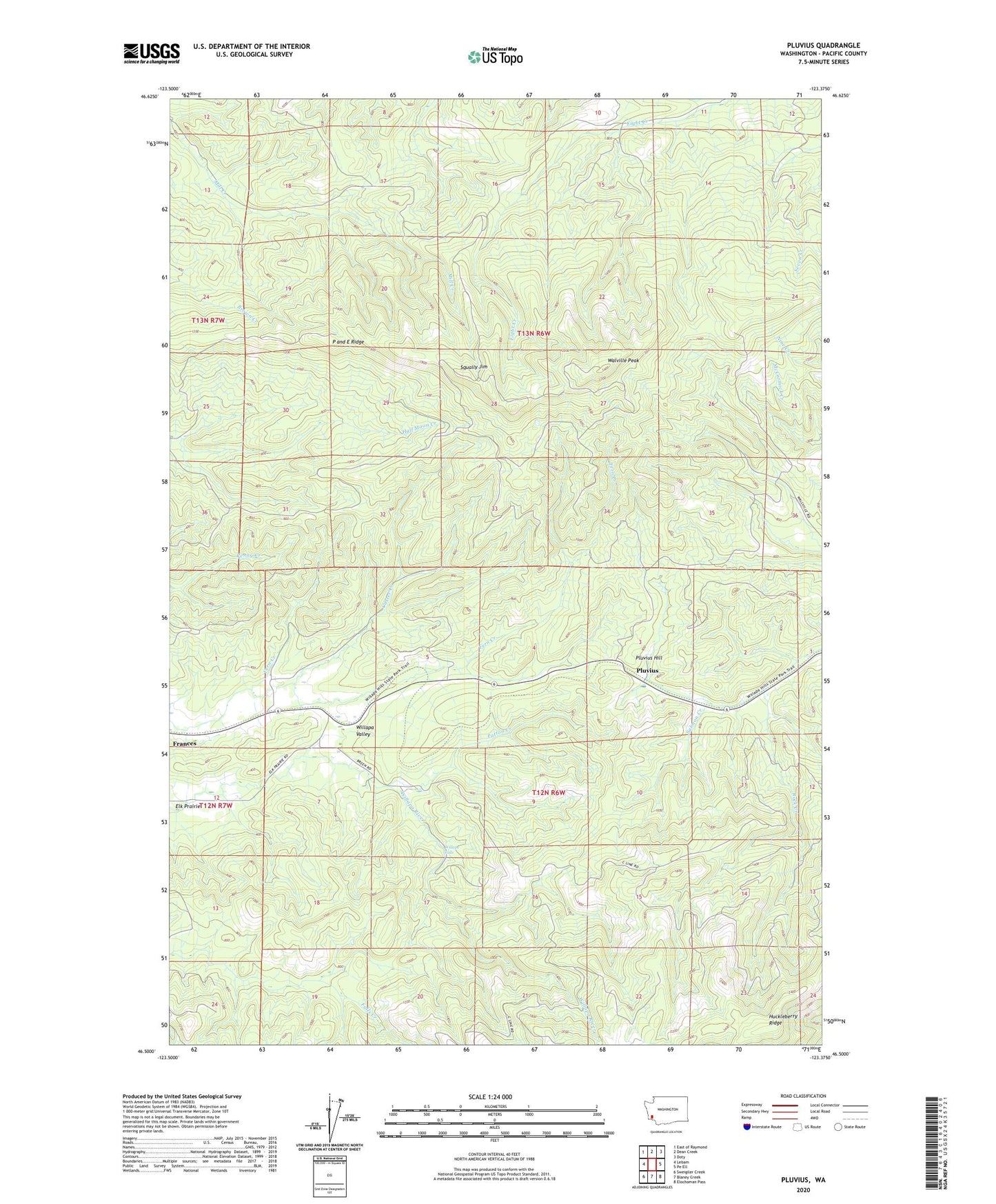
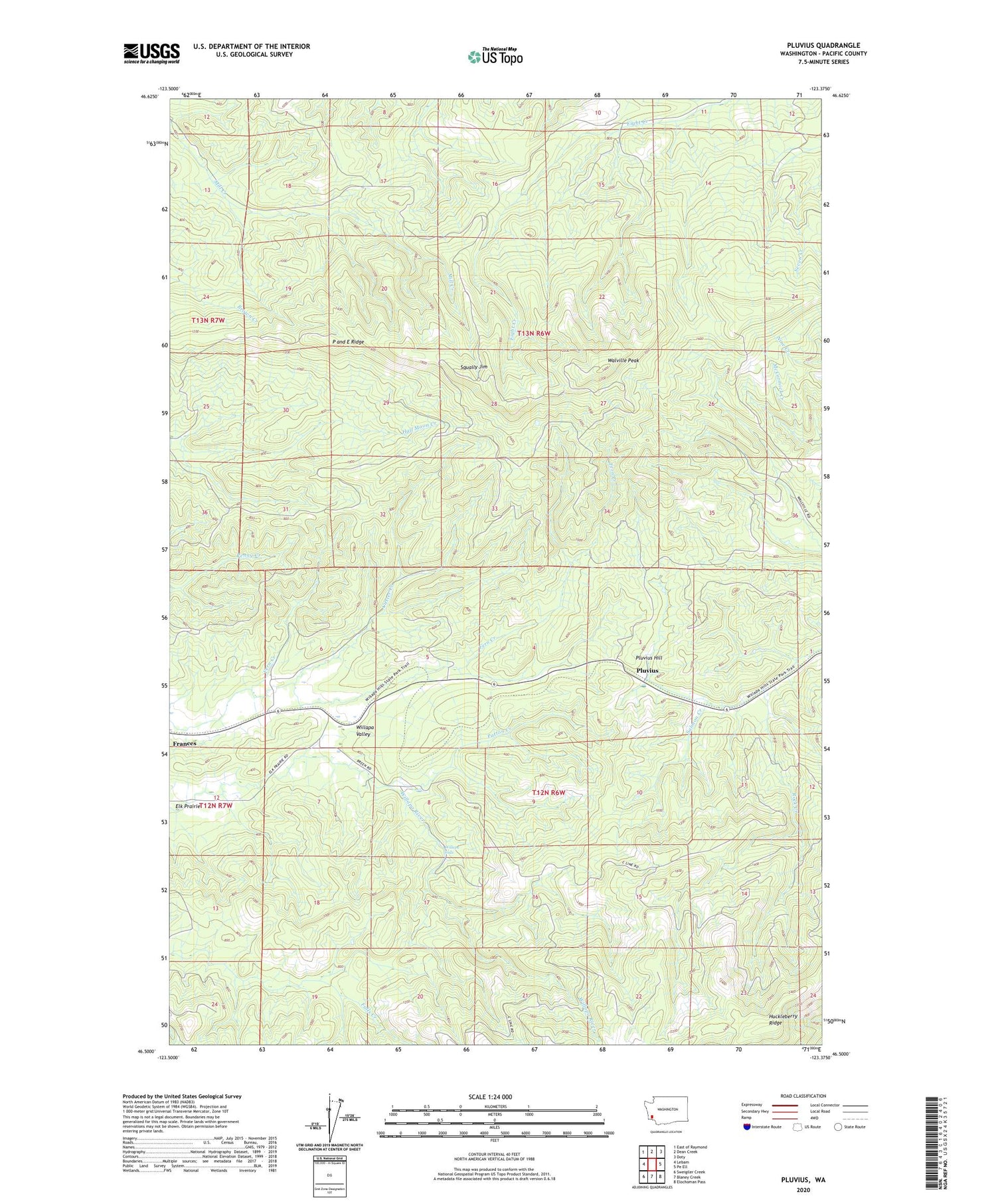
2020 topographic map quadrangle Pluvius in the state of Washington. Scale: 1:24000. Based on the newly updated USGS 7.5' US Topo map series, this map is in the following counties: Pacific. The map contains contour data, water features, and other items you are used to seeing on USGS maps, but also has updated roads and other features. This is the next generation of topographic maps. Printed on high-quality waterproof paper with UV fade-resistant inks.
Quads adjacent to this one:
West: Lebam
Northwest: East of Raymond
North: Dean Creek
Northeast: Doty
East: Pe Ell
Southeast: Elochoman Pass
South: Blaney Creek
Southwest: Sweigiler Creek
Contains the following named places: Custer Creek, Fern Creek, Patton Creek, Pluvius, Pluvius Hill, Salmon Creek, Squally Jim, Walville Peak, Willapa Falls