MyTopo
Sweigiler Creek Washington US Topo Map
Couldn't load pickup availability
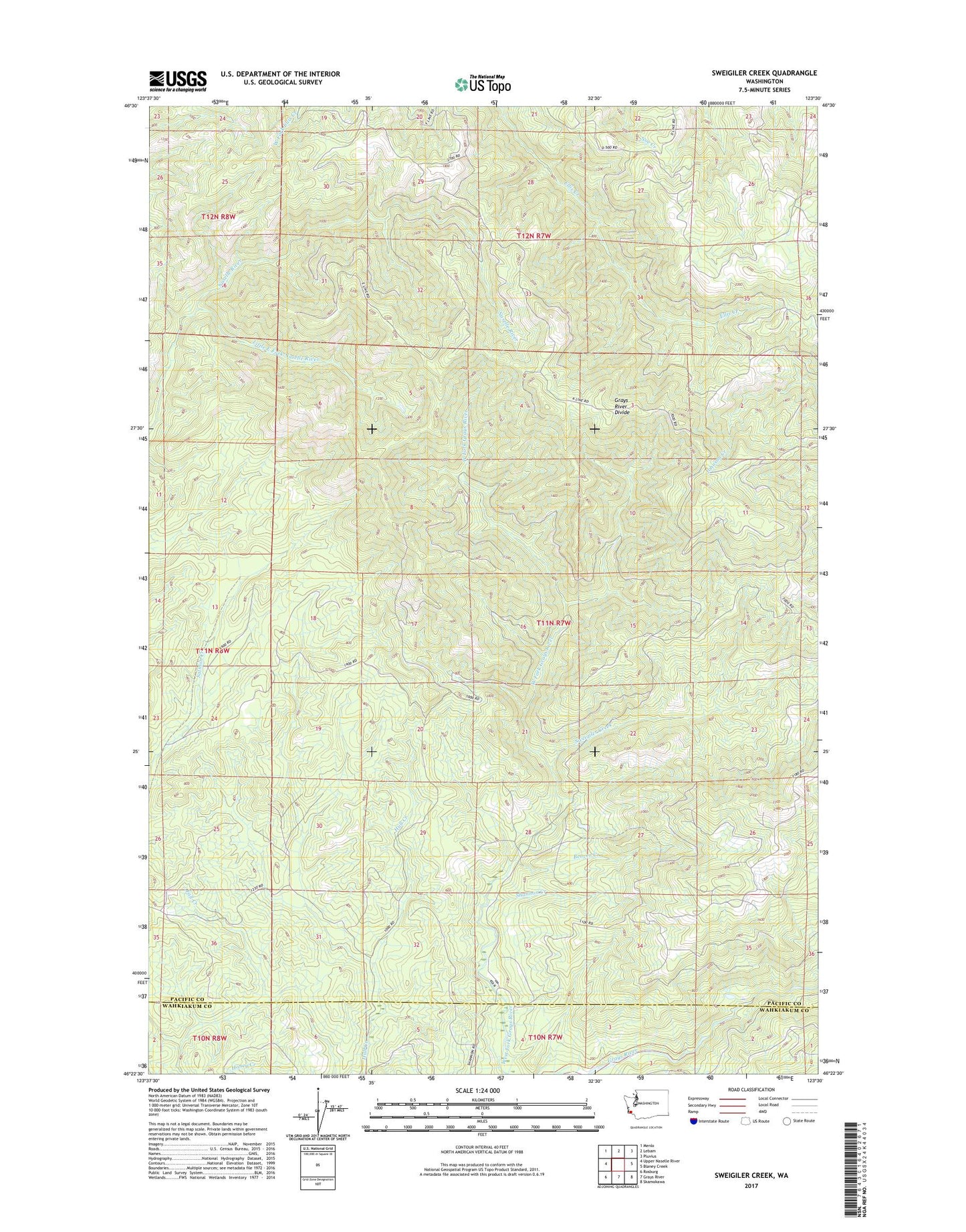
2023 topographic map quadrangle Sweigiler Creek in the state of Washington. Scale: 1:24000. Based on the newly updated USGS 7.5' US Topo map series, this map is in the following counties: Pacific, Wahkiakum. The map contains contour data, water features, and other items you are used to seeing on USGS maps, but also has updated roads and other features. This is the next generation of topographic maps. Printed on high-quality waterproof paper with UV fade-resistant inks.
Quads adjacent to this one:
West: Upper Naselle River
Northwest: Menlo
North: Lebam
Northeast: Pluvius
East: Blaney Creek
Southeast: Skamokawa
South: Grays River
Southwest: Rosburg
This map covers the same area as the classic USGS quad with code o46123d5.
Contains the following named places: Beaver Creek, Grays River Divide, Grays River State Fish Hatchery, Hull Creek Lookout, Little East Fork Naselle River, Shannon Creek, Sweigiler Creek, ZIP Code: 98621