MyTopo
Lebam Washington US Topo Map
Couldn't load pickup availability
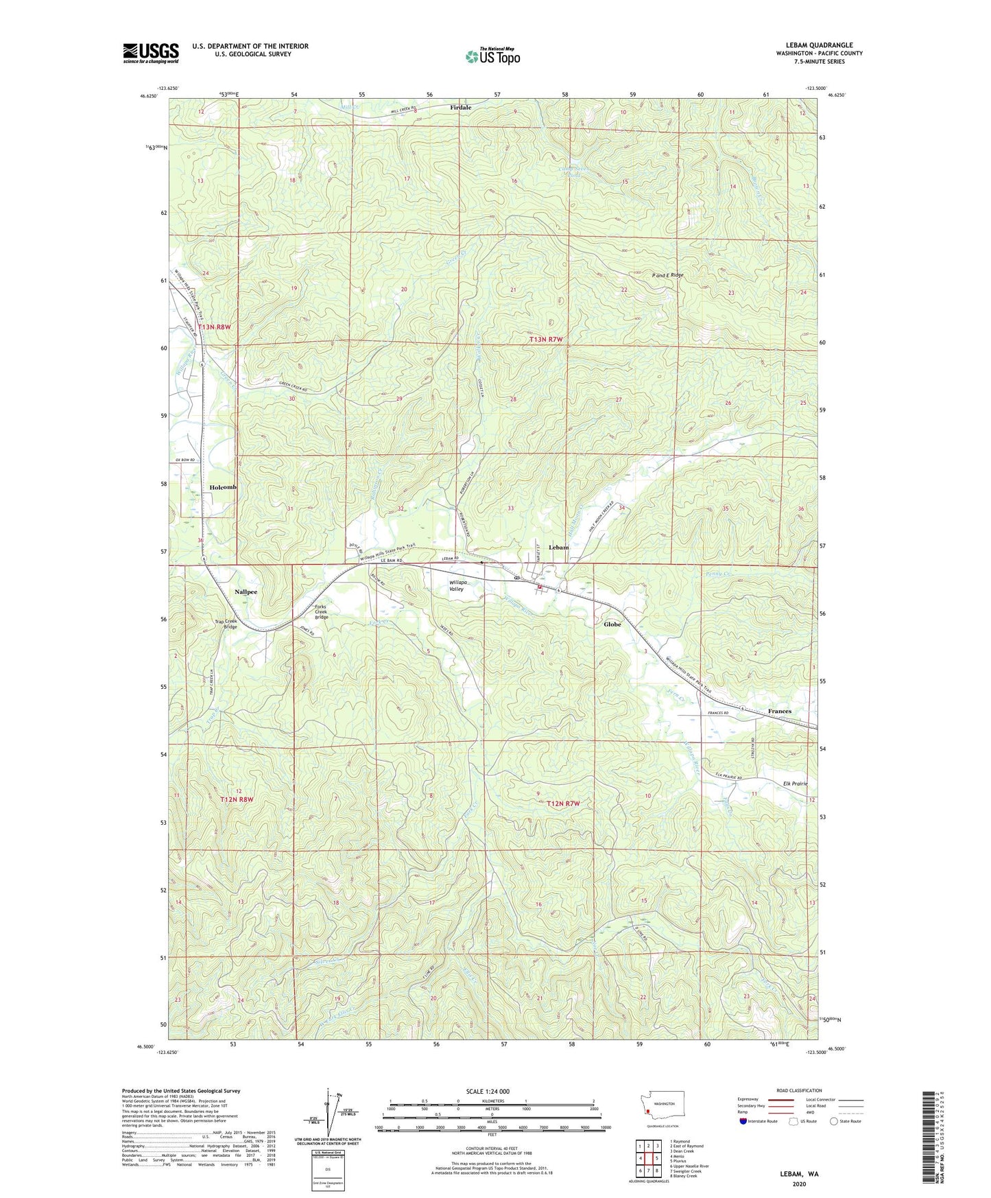
2023 topographic map quadrangle Lebam in the state of Washington. Scale: 1:24000. Based on the newly updated USGS 7.5' US Topo map series, this map is in the following counties: Pacific. The map contains contour data, water features, and other items you are used to seeing on USGS maps, but also has updated roads and other features. This is the next generation of topographic maps. Printed on high-quality waterproof paper with UV fade-resistant inks.
Quads adjacent to this one:
West: Menlo
Northwest: Raymond
North: East of Raymond
Northeast: Dean Creek
East: Pluvius
Southeast: Blaney Creek
South: Sweigiler Creek
Southwest: Upper Naselle River
This map covers the same area as the classic USGS quad with code o46123e5.
Contains the following named places: Camp Seven Pond, Camp Seven Pond Number Two Dam, Elk Prairie, Ellis Creek, Falls Creek, Fern Creek, Firdale, Fork Creek, Forks Creek Bridge, Forks Creek Hatchery, Frances, Globe, Green Creek, Half Moon Creek, Holcomb, Lebam, Lebam Census Designated Place, Lebam Community Church, Lebam Elementary School, Lebam Post Office, Nallpee, Noe Creek, P and E Ridge, Pacific County Fire District 3 Lebam, Penny Creek, Robinson Creek, Sienko Dam, Silver Creek, Talbot Dam, Trap Creek, Trap Creek Bridge, Walker Creek, West Fork Ellis Creek, Willapa Valley Division