MyTopo
Hagerty Butte Washington US Topo Map
Couldn't load pickup availability
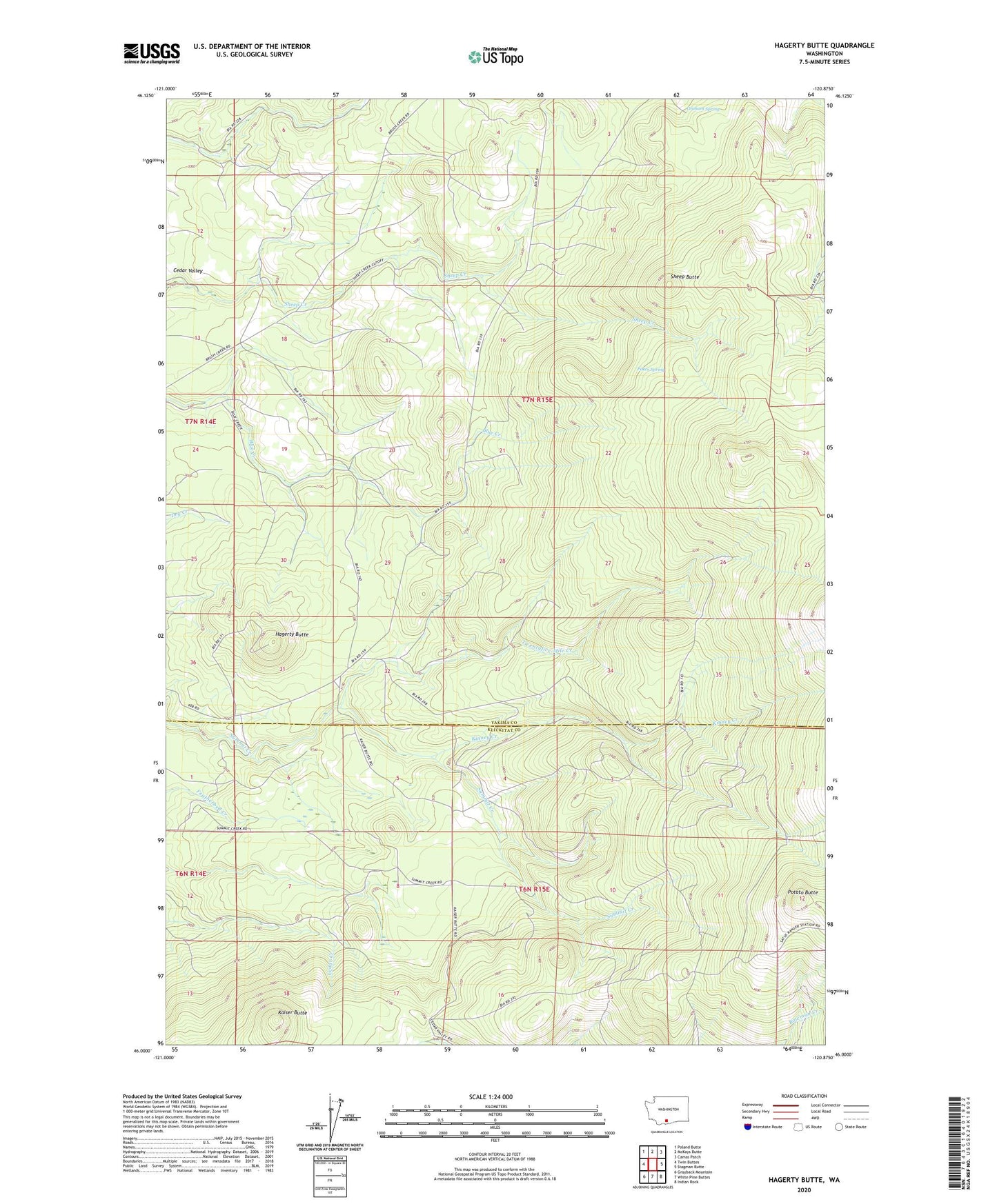
2023 topographic map quadrangle Hagerty Butte in the state of Washington. Scale: 1:24000. Based on the newly updated USGS 7.5' US Topo map series, this map is in the following counties: Yakima, Klickitat. The map contains contour data, water features, and other items you are used to seeing on USGS maps, but also has updated roads and other features. This is the next generation of topographic maps. Printed on high-quality waterproof paper with UV fade-resistant inks.
Quads adjacent to this one:
West: Twin Buttes
Northwest: Poland Butte
North: McKays Butte
Northeast: Camas Patch
East: Stagman Butte
Southeast: Indian Rock
South: White Pine Buttes
Southwest: Grayback Mountain
This map covers the same area as the classic USGS quad with code o46120a8.
Contains the following named places: Featherbed Camp, Garner Camp, Graham Spring, Hagerty Butte, Kaiser Butte, Kaiser Butte Guard Station, Kinney Creek, Poker Spring, Potato Butte, Sheep Butte, Twentyfive Mile Creek, Yeackel Camp