MyTopo
Reade Hill Washington US Topo Map
Couldn't load pickup availability
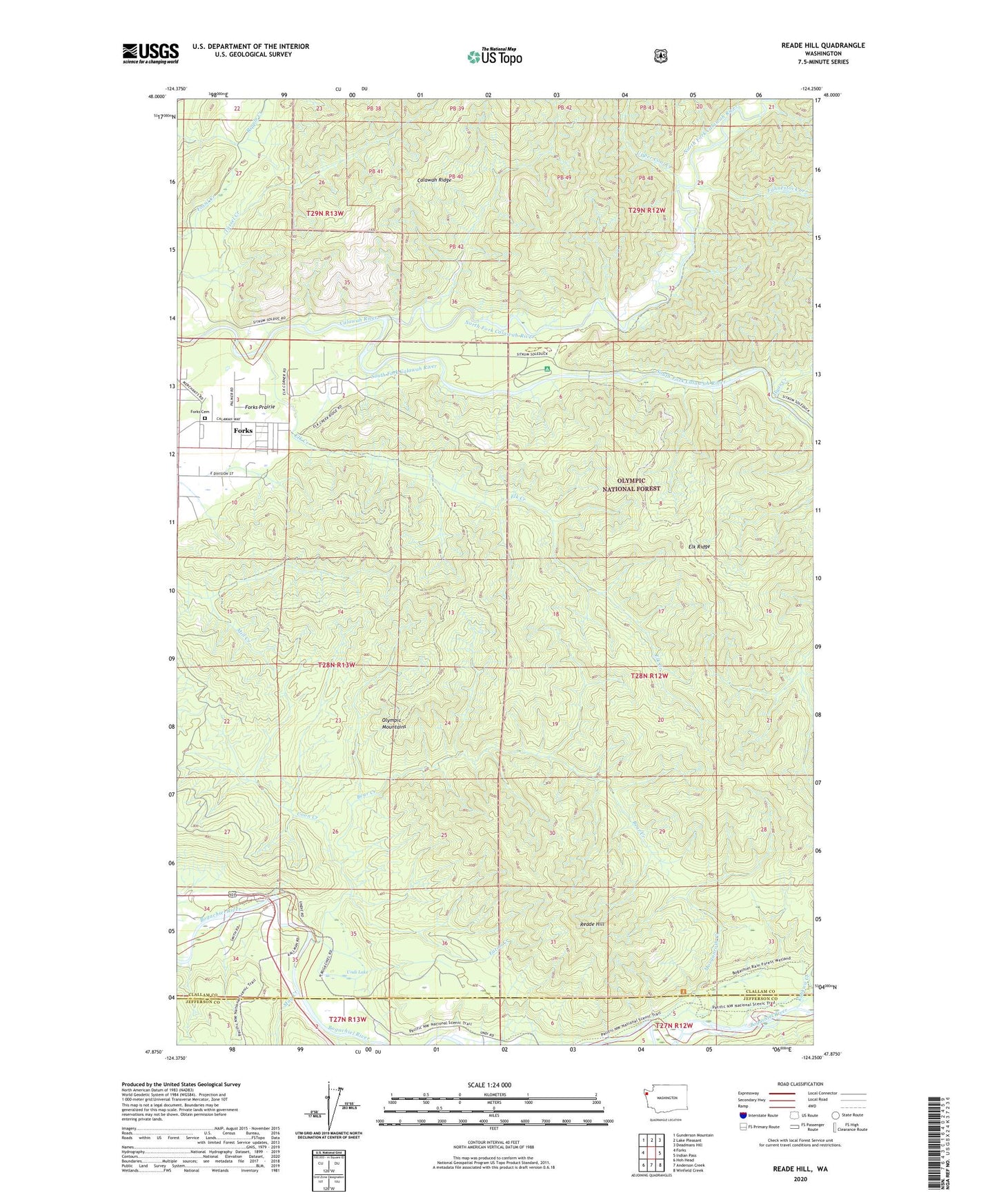
2020 topographic map quadrangle Reade Hill in the state of Washington. Scale: 1:24000. Based on the newly updated USGS 7.5' US Topo map series, this map is in the following counties: Clallam, Jefferson. The map contains contour data, water features, and other items you are used to seeing on USGS maps, but also has updated roads and other features. This is the next generation of topographic maps. Printed on high-quality waterproof paper with UV fade-resistant inks.
Quads adjacent to this one:
West: Forks
Northwest: Gunderson Mountain
North: Lake Pleasant
Northeast: Deadmans Hill
East: Indian Pass
Southeast: Winfield Creek
South: Anderson Creek
Southwest: Hoh Head
Contains the following named places: Alder Grove Mobile Home Park, Bear Creek, Bogachiel State Park, Bogachiel Trail, Coon Creek, Eaton Creek, Elk Creek, Elk Creek Mobile Home Park, Elk Ridge, Fahnestock Creek, Forks Cemetery, Forks Ranger Station, Forks Seventh Day Adventist Church, Forks Seventh Day Adventist School, Hyas Creek, Klahanie Campground, May Creek, Morganroth Creek, North Fork Calawah River, Reade Hill, South Fork Calawah River, The Church of Jesus Christ of Latter Day Saints, Undi Lake, Upper Cool Creek