
MyTopo
Riley Lake Washington US Topo Map
Couldn't load pickup availability
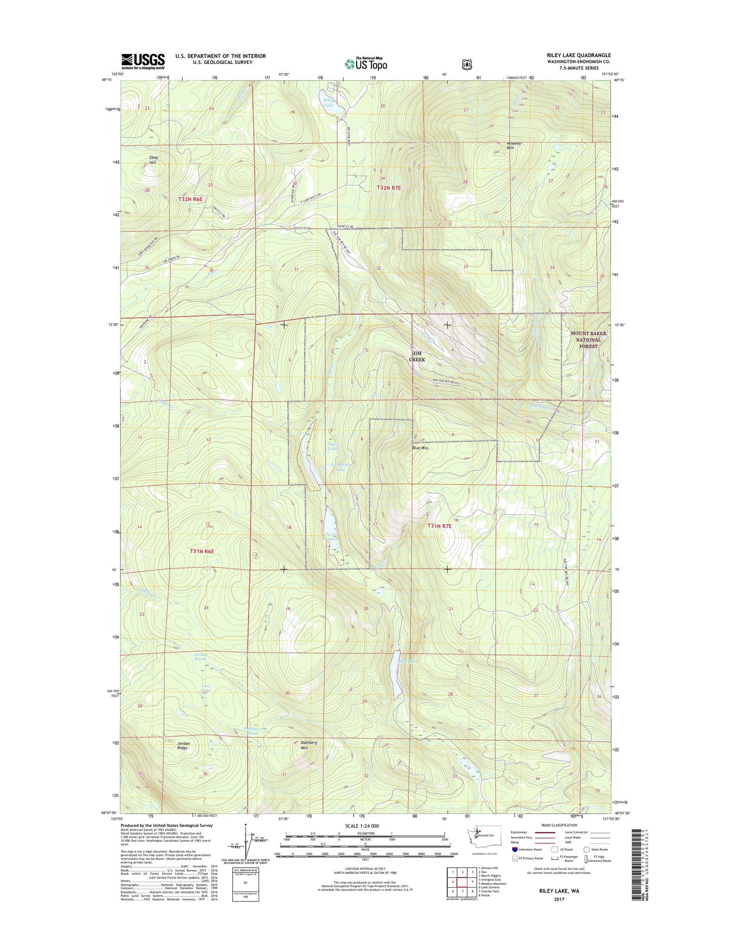
2020 topographic map quadrangle Riley Lake in the state of Washington. Scale: 1:24000. Based on the newly updated USGS 7.5' US Topo map series, this map is in the following counties: Snohomish. The map contains contour data, water features, and other items you are used to seeing on USGS maps, but also has updated roads and other features. This is the next generation of topographic maps. Printed on high-quality waterproof paper with UV fade-resistant inks.
Quads adjacent to this one:
West: Arlington East
Northwest: Stimson Hill
North: Oso
Northeast: Mount Higgins
East: Meadow Mountain
Southeast: Verlot
South: Granite Falls
Southwest: Lake Stevens
Contains the following named places: Arlington Division, Big Jim Creek, Blue Mountain, Chain Lakes, Cub Creek, Dahlberg Mountain, Dahlberg Ponds, Jim Creek Naval Radio Station, Jordan Ponds, Jordan Ridge, La Barge Lake, Little Jim Creek, Lost Lake, Mud Lake, Riley Lake, Twin Lakes, Walter R. Briggs Old Growth Forest Area, Wheeler Mountain, ZIP Code: 98223


