MyTopo
Stimson Hill Washington US Topo Map
Couldn't load pickup availability
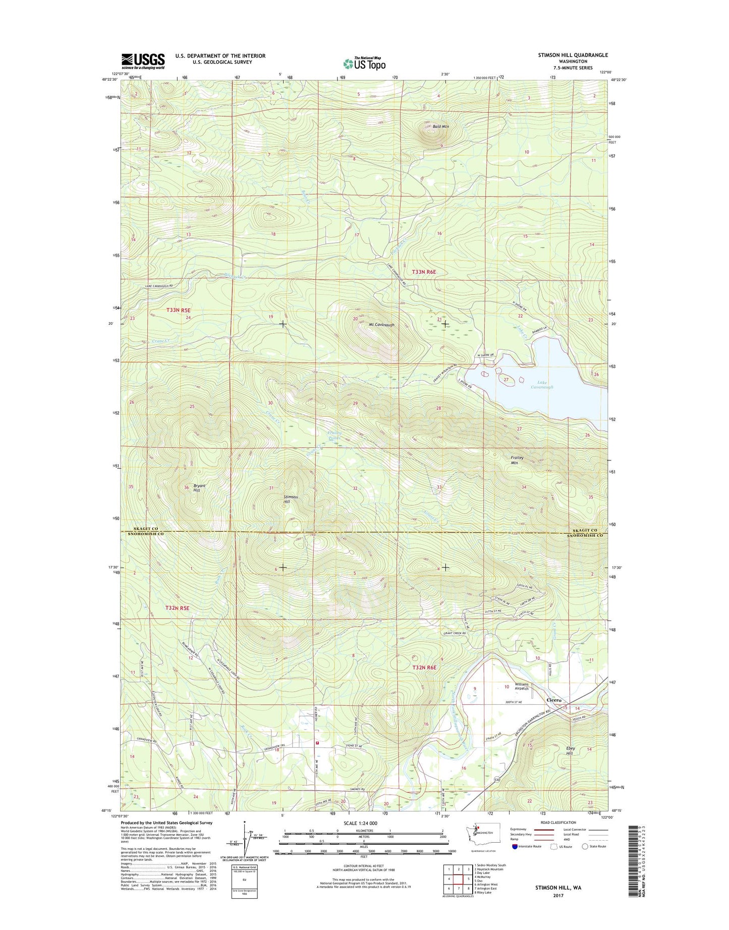
2023 topographic map quadrangle Stimson Hill in the state of Washington. Scale: 1:24000. Based on the newly updated USGS 7.5' US Topo map series, this map is in the following counties: Skagit, Snohomish. The map contains contour data, water features, and other items you are used to seeing on USGS maps, but also has updated roads and other features. This is the next generation of topographic maps. Printed on high-quality waterproof paper with UV fade-resistant inks.
Quads adjacent to this one:
West: McMurray
Northwest: Sedro-Woolley South
North: Haystack Mountain
Northeast: Day Lake
East: Oso
Southeast: Riley Lake
South: Arlington East
Southwest: Arlington West
This map covers the same area as the classic USGS quad with code o48122c1.
Contains the following named places: Alexander Trail, Bald Mountain, Bear Creek, Bryant Hill, Cicero, Frailey Mountain Truck Trail, Frailey Ponds, Grandview Recreation Center, Grant Creek, Lake Cavanaugh, Lake Cavanaugh Census Designated Place, Lake Creek, Mount Cavanaugh, Mount Washington Trail, North County Fire / Emergency Medical Services Station 92 Grandview, North Fork Dairy, Spar Tree Trail, Stimson Hill, Strawder Dairy, Williams Airpatch