MyTopo
Rimrock Lake Washington US Topo Map
Couldn't load pickup availability
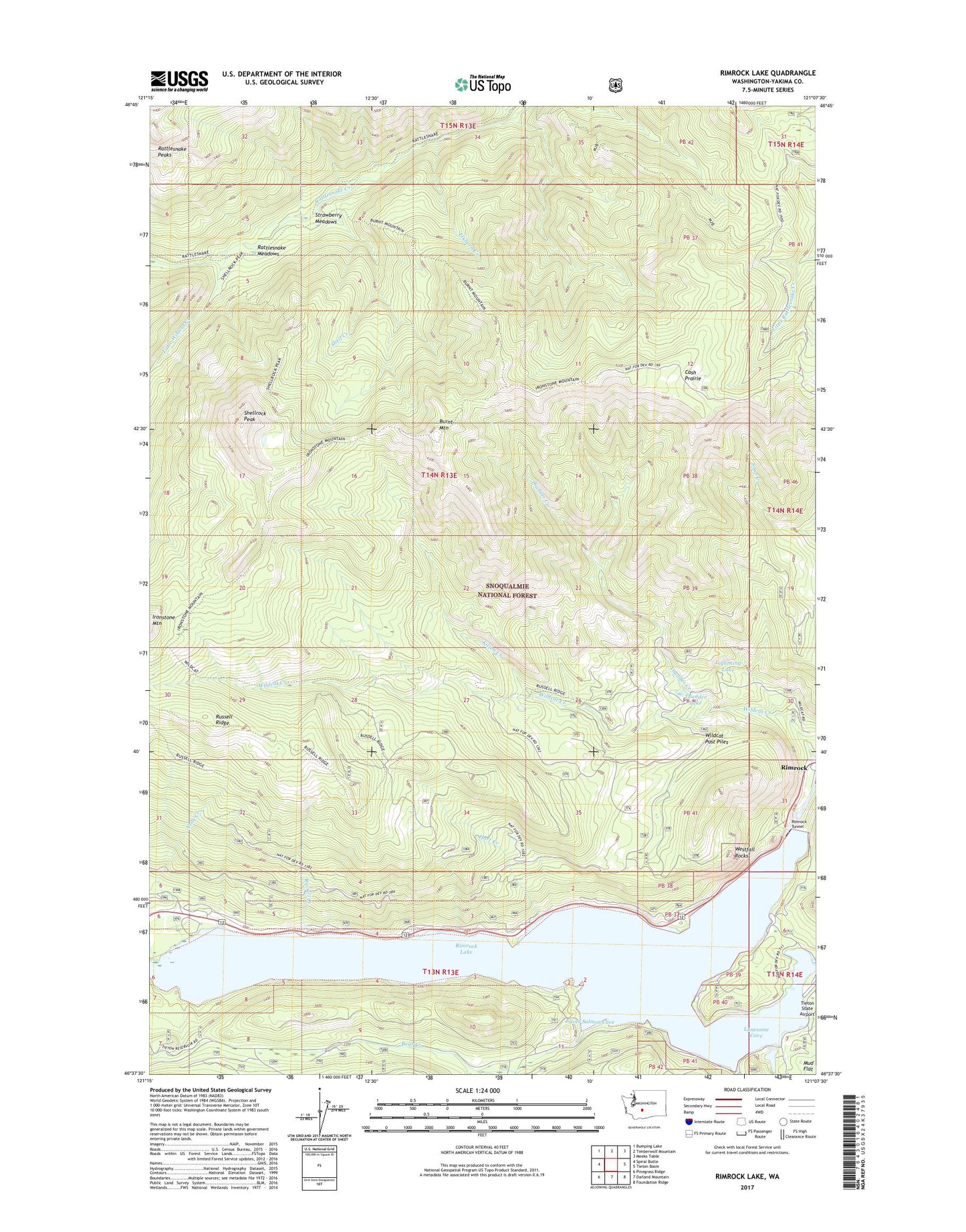
2020 topographic map quadrangle Rimrock Lake in the state of Washington. Scale: 1:24000. Based on the newly updated USGS 7.5' US Topo map series, this map is in the following counties: Yakima. The map contains contour data, water features, and other items you are used to seeing on USGS maps, but also has updated roads and other features. This is the next generation of topographic maps. Printed on high-quality waterproof paper with UV fade-resistant inks.
Quads adjacent to this one:
West: Spiral Butte
Northwest: Bumping Lake
North: Timberwolf Mountain
Northeast: Meeks Table
East: Tieton Basin
Southeast: Foundation Ridge
South: Darland Mountain
Southwest: Pinegrass Ridge
Contains the following named places: Andy Creek, Bear Creek, Burnt Mountain, Cash Prairie, Elkhorn Creek, Hart Creek, Indian Creek, Indian Creek Campground, Kitten Creek, Lightning Lake, Little Wildcat Creek, Lonesome Cove, Lonesome Cove Campground, McAllister Meadow, Peninsula Campground, Rattlesnake Meadows, Rimrock, Rimrock Lake, Rimrock Lake Resort and Marina, Rimrock Landing, Rimrock Public Campground and Boat Landing, Rimrock Tunnel, Russell Creek, Russell Creek Picnic Area, Shell Creek, Shellrock Peak, Silver Beach, Silver Cove Resort, Silver Salmon Cove, Strawberry Meadows, Thunder Creek, Thunder Lake, Tieton Dam, Twelve Point Resort, Westfall Rocks, Wildcat Post Piles