MyTopo
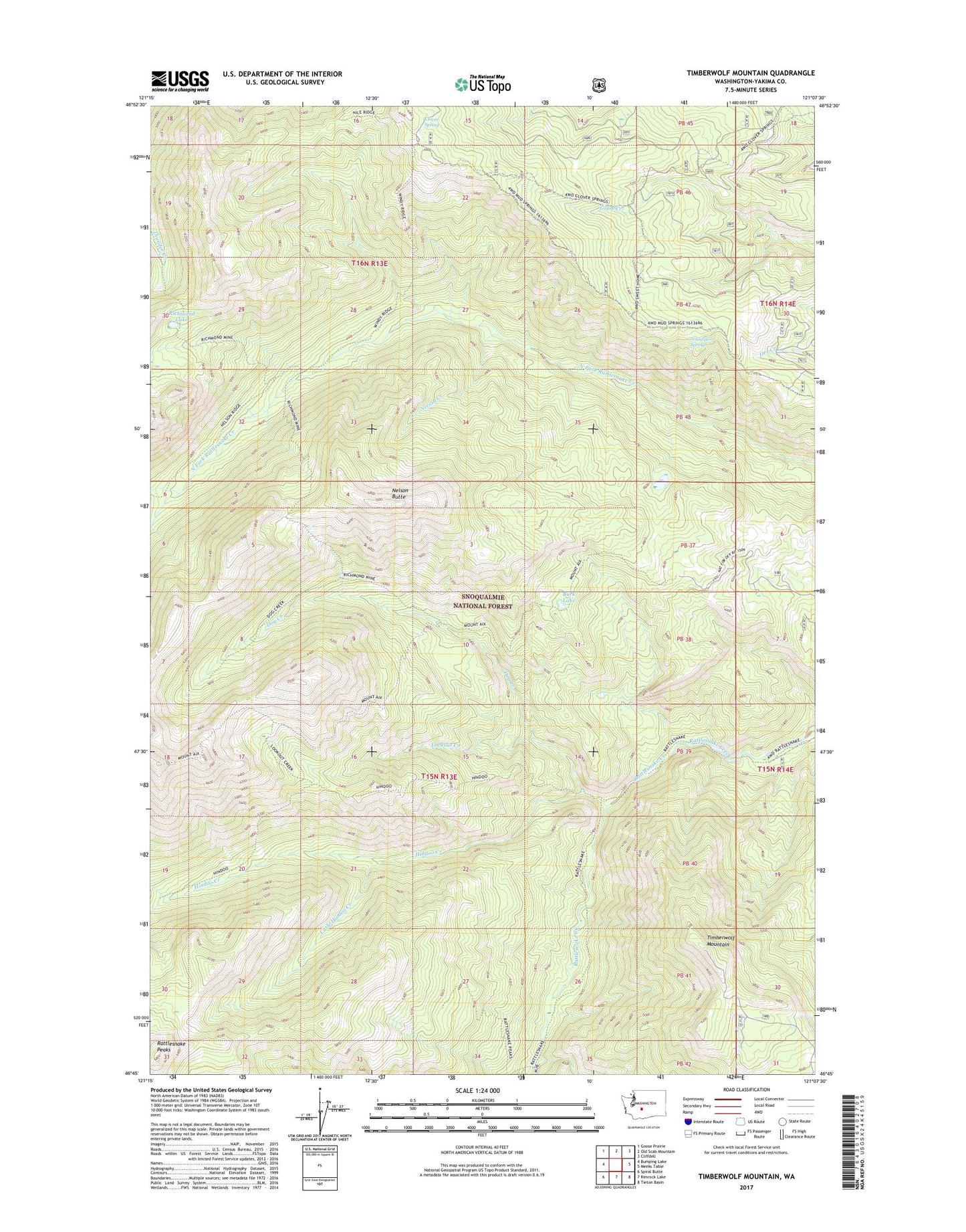
Timberwolf Mountain Washington US Topo Map
Couldn't load pickup availability
Also explore the Timberwolf Mountain Forest Service Topo of this same quad for updated USFS data
2023 topographic map quadrangle Timberwolf Mountain in the state of Washington. Scale: 1:24000. Based on the newly updated USGS 7.5' US Topo map series, this map is in the following counties: Yakima. The map contains contour data, water features, and other items you are used to seeing on USGS maps, but also has updated roads and other features. This is the next generation of topographic maps. Printed on high-quality waterproof paper with UV fade-resistant inks.
Quads adjacent to this one:
West: Bumping Lake
Northwest: Goose Prairie
North: Old Scab Mountain
Northeast: Cliffdell
East: Meeks Table
Southeast: Tieton Basin
South: Rimrock Lake
Southwest: Spiral Butte
This map covers the same area as the classic USGS quad with code o46121g2.
Contains the following named places: Buck Lake, Clover Spring, Clover Springs Lookout, Dog Creek, Hindoo Creek, Little Hindoo Creek, Lookout Creek, Nelson Butte, Nelson Creek, Rattlesnake Peaks, Richmond Lake, Schneider Springs, Timberwolf Mountain, ZIP Code: 98937