MyTopo
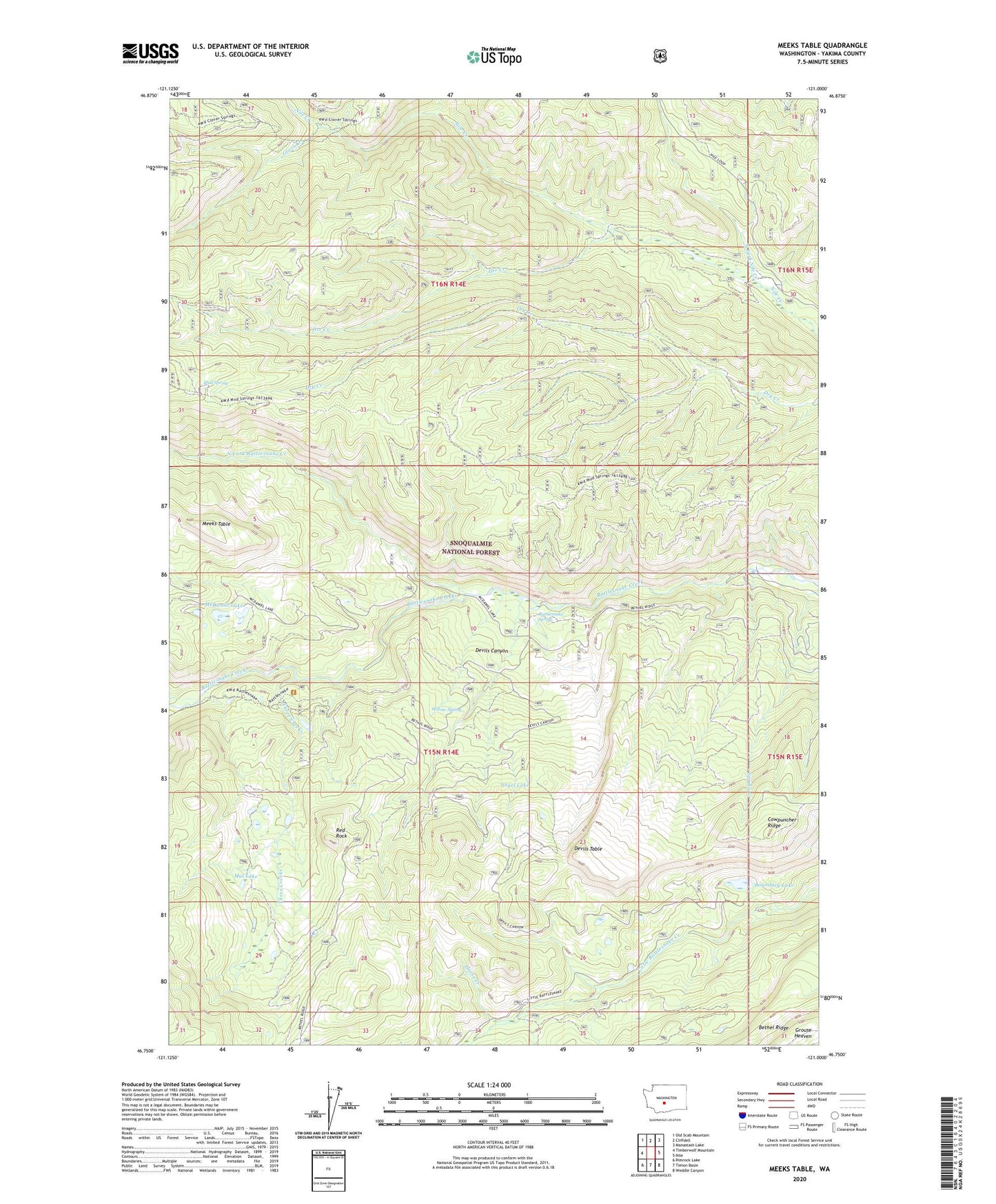
Meeks Table Washington US Topo Map
Couldn't load pickup availability
Also explore the Meeks Table Forest Service Topo of this same quad for updated USFS data
2023 topographic map quadrangle Meeks Table in the state of Washington. Scale: 1:24000. Based on the newly updated USGS 7.5' US Topo map series, this map is in the following counties: Yakima. The map contains contour data, water features, and other items you are used to seeing on USGS maps, but also has updated roads and other features. This is the next generation of topographic maps. Printed on high-quality waterproof paper with UV fade-resistant inks.
Quads adjacent to this one:
West: Timberwolf Mountain
Northwest: Old Scab Mountain
North: Cliffdell
Northeast: Manastash Lake
East: Nile
Southeast: Weddle Canyon
South: Tieton Basin
Southwest: Rimrock Lake
This map covers the same area as the classic USGS quad with code o46121g1.
Contains the following named places: Angel Lake, Boundary Lake, Cowpuncher Ridge, Devils Canyon, Devils Table, Glass Creek, Grouse Heaven, Horse Creek, Mal Lake, McDaniel Lake, Meeks Table, Meeks Table Natural Area, Mount Aix Vista, Mud Spring, North Fork Nile Creek, North Fork Rattlesnake Creek, Northwest Yakima Division, Orr Creek, Rattlesnake Forks, Rattlesnake Guard Station, Rattlesnake Spring, Red Rock, Spring Creek, Three Creeks, Willow Spring