MyTopo
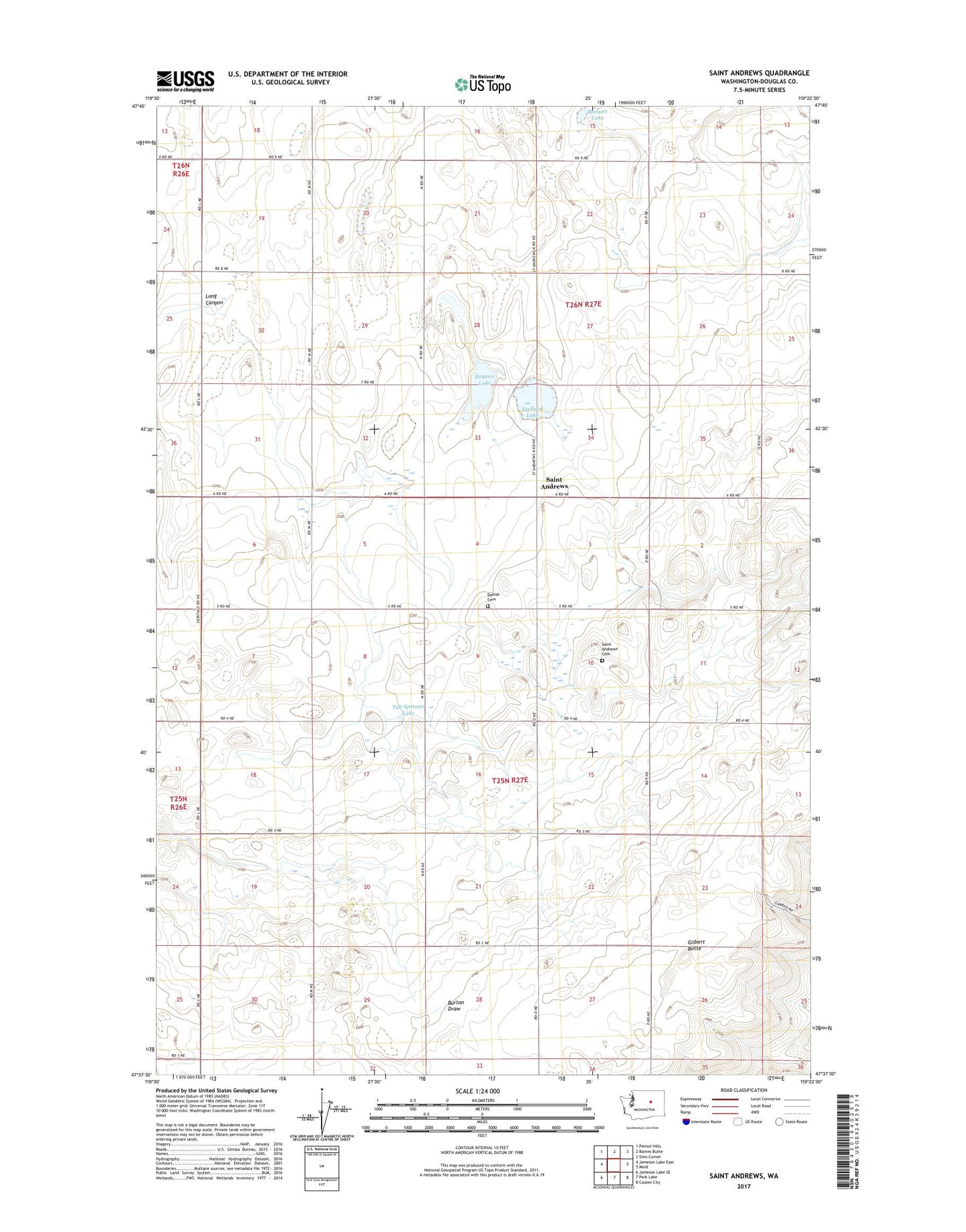
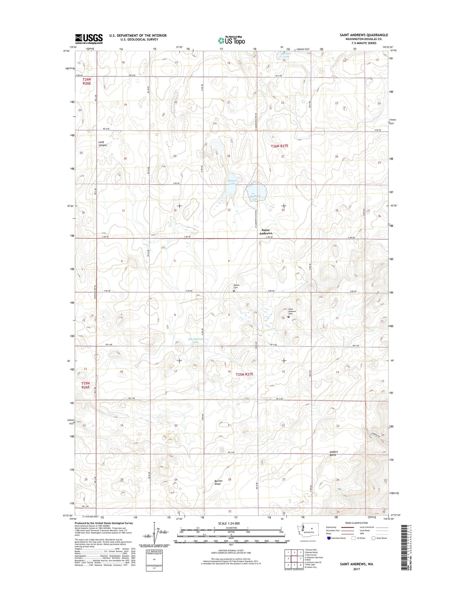
Saint Andrews Washington US Topo Map
Couldn't load pickup availability
2020 topographic map quadrangle Saint Andrews in the state of Washington. Scale: 1:24000. Based on the newly updated USGS 7.5' US Topo map series, this map is in the following counties: Douglas. The map contains contour data, water features, and other items you are used to seeing on USGS maps, but also has updated roads and other features. This is the next generation of topographic maps. Printed on high-quality waterproof paper with UV fade-resistant inks.
Quads adjacent to this one:
West: Jameson Lake East
Northwest: Piersol Hills
North: Barnes Butte
Northeast: Sims Corner
East: Mold
Southeast: Coulee City
South: Park Lake
Southwest: Jameson Lake SE
Contains the following named places: Bennett Lake, Danish Cemetery, Gilbert Butte, Haynes Lake, Jenkins-Webley Dam, Jorgensen Dam, Saint Andrews, Saint Andrews Cemetery, Stallard Lake, Tub Springs Lake, ZIP Code: 99115