MyTopo
South Navarre Peak Washington US Topo Map
Couldn't load pickup availability
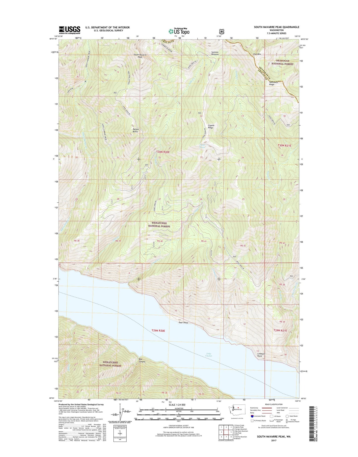
2020 topographic map quadrangle South Navarre Peak in the state of Washington. Scale: 1:24000. Based on the newly updated USGS 7.5' US Topo map series, this map is in the following counties: Chelan, Okanogan. The map contains contour data, water features, and other items you are used to seeing on USGS maps, but also has updated roads and other features. This is the next generation of topographic maps. Printed on high-quality waterproof paper with UV fade-resistant inks.
Quads adjacent to this one:
West: Big Goat Mountain
Northwest: Prince Creek
North: Martin Peak
Northeast: Hungry Mountain
East: Oss Peak
Southeast: Manson
South: Stormy Mountain
Southwest: Brief
Contains the following named places: Box Canyon, Camas Creek, Coyote Creek, Coyote Ridge, Coyote Spring, Deer Point, Deer Point Campground, End Mountain, Falls Creek, Grade Creek, Lake Chelan, Limekiln Point, Little Grade Creek, Nelson Butte, Nelson Butte Lookout, Safety Harbor Creek Campground, South Navarre Campground, South Navarre Peak, Still Creek, Summer Blossom, ZIP Code: 98816