MyTopo
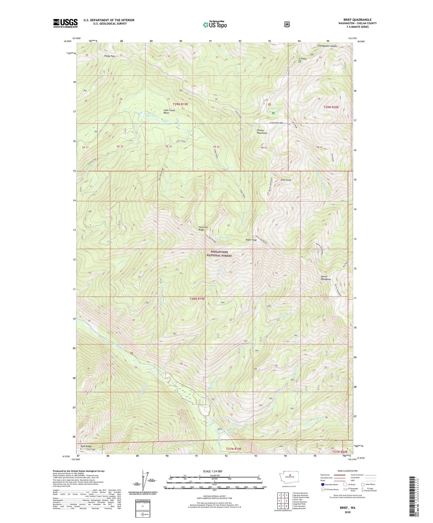
Brief Washington US Topo Map
Couldn't load pickup availability
Also explore the Brief Forest Service Topo of this same quad for updated USFS data
2023 topographic map quadrangle Brief in the state of Washington. Scale: 1:24000. Based on the newly updated USGS 7.5' US Topo map series, this map is in the following counties: Chelan. The map contains contour data, water features, and other items you are used to seeing on USGS maps, but also has updated roads and other features. This is the next generation of topographic maps. Printed on high-quality waterproof paper with UV fade-resistant inks.
Quads adjacent to this one:
West: Silver Falls
Northwest: Pyramid Mountain
North: Big Goat Mountain
Northeast: South Navarre Peak
East: Stormy Mountain
Southeast: Baldy Mountain
South: Tyee Mountain
Southwest: Sugarloaf Peak
This map covers the same area as the classic USGS quad with code o47120h4.
Contains the following named places: Angle Peak, Bear Lake, Brennegan Creek, Brief, Burns Creek, Chelan Mountains, Chesapeake Saddle, Crescent Hill, Devils Backbone, East Point, Fourmile Ridge, Grandma Creek, Handy Spring, Handy Spring Campground, Hazel Camp, Junior Point, Junior Point Campground, Junior Point Lookout, Lake Creek Basin, Lower Pawn Lake, McCrea Creek, Mott Creek, Pawn Lakes, Preston Creek, Preston Falls, Shady Pass, Shady Pass Campground, South Fork Preston Creek, Upper Pawn Lake