MyTopo
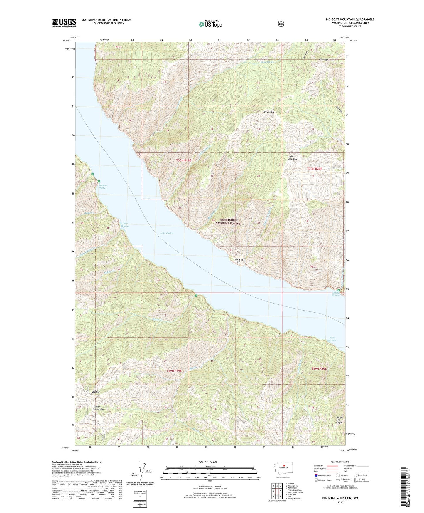
Big Goat Mountain Washington US Topo Map
Couldn't load pickup availability
Also explore the Big Goat Mountain Forest Service Topo of this same quad for updated USFS data
2023 topographic map quadrangle Big Goat Mountain in the state of Washington. Scale: 1:24000. Based on the newly updated USGS 7.5' US Topo map series, this map is in the following counties: Chelan. The map contains contour data, water features, and other items you are used to seeing on USGS maps, but also has updated roads and other features. This is the next generation of topographic maps. Printed on high-quality waterproof paper with UV fade-resistant inks.
Quads adjacent to this one:
West: Pyramid Mountain
Northwest: Lucerne
North: Prince Creek
Northeast: Martin Peak
East: South Navarre Peak
Southeast: Stormy Mountain
South: Brief
Southwest: Silver Falls
This map covers the same area as the classic USGS quad with code o48120a4.
Contains the following named places: Barney Zell Ridge, Big Creek, Big Creek Campground, Big Goat Creek, Big Goat Mountain, Big Hill, Big Hill Campground, Corral Creek, Corral Creek Campground, Deep Harbor, Deep Harbor Creek, Finn Harbor, Graham Harbor, Graham Harbor Campground, Graham Harbor Creek, Graham Harbor Creek Campground, Little Big Creek, Little Goat Creek, Little Goat Mountain, Lone Fir Creek, Nobby Creek, Point No Point, Point No Point Creek, Ridge Creek, Safety Harbor, Safety Harbor Campground, Safety Harbor Creek, Uno Peak