MyTopo
Sultan Washington US Topo Map
Couldn't load pickup availability
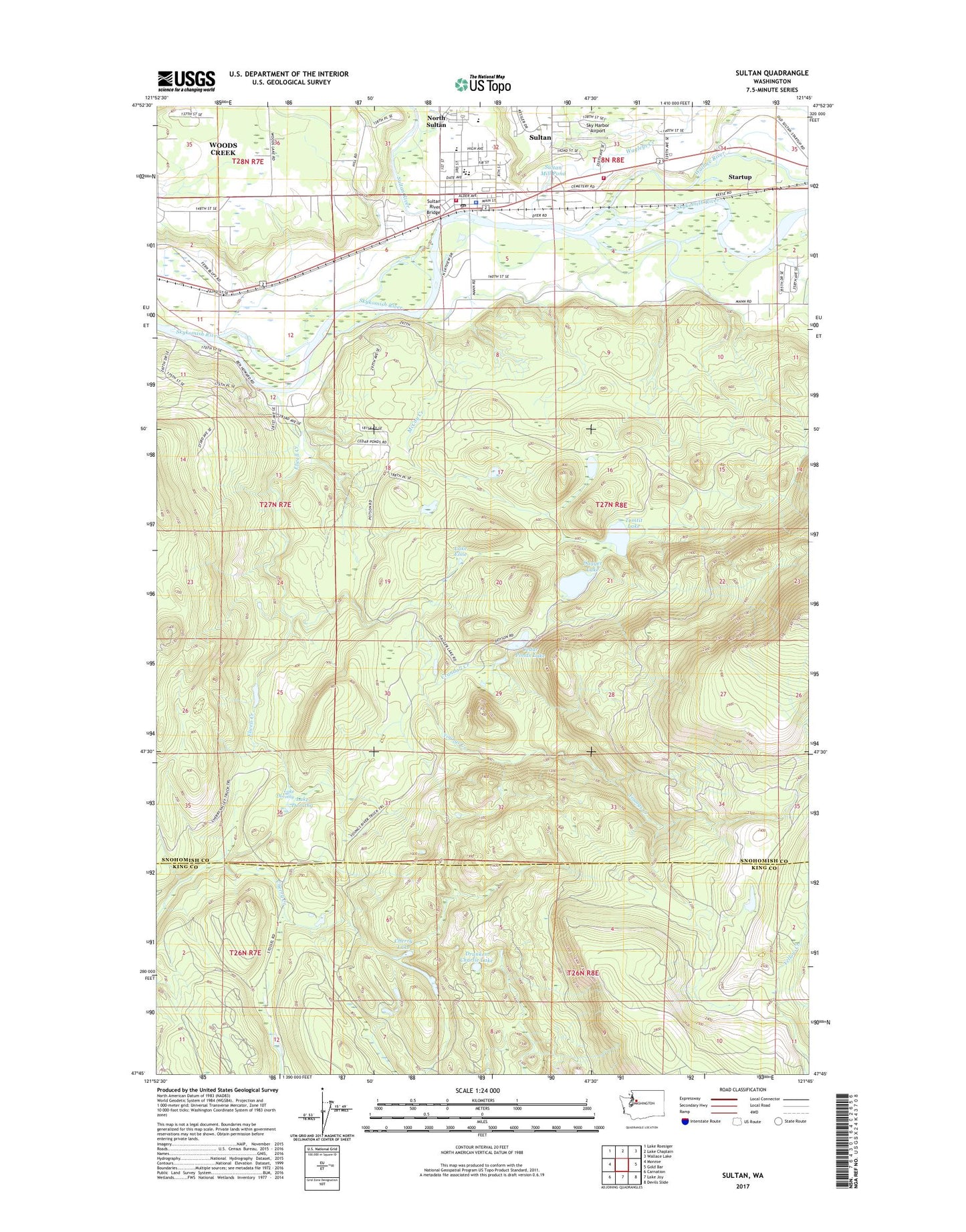
2020 topographic map quadrangle Sultan in the state of Washington. Scale: 1:24000. Based on the newly updated USGS 7.5' US Topo map series, this map is in the following counties: Snohomish, King. The map contains contour data, water features, and other items you are used to seeing on USGS maps, but also has updated roads and other features. This is the next generation of topographic maps. Printed on high-quality waterproof paper with UV fade-resistant inks.
Quads adjacent to this one:
West: Monroe
Northwest: Lake Roesiger
North: Lake Chaplain
Northeast: Wallace Lake
East: Gold Bar
Southeast: Devils Slide
South: Lake Joy
Southwest: Carnation
Contains the following named places: Cedar Ponds Lake, Centennial Park, Cherry Hill Estates Mobile Home Park, Cherry Lake, City of Sultan, Crandall Creek, Dagger Lake, Dagger Lake Dam, Double M Ranch, Drunken Charlie Lake, Elwell Creek, Groeneveld Farms, Haystack Lookout, Hofstra Dairy, Lake Dorothy, Lake Elsie, McCoy Creek, McCoy Creek Dam, Roesler Timber Company Heliport, Rudolf Reese Park, Sky Harbor Airport, Sky Valley Options High School, Snohomish County Fire District 5 Station 51, Startup Census Designated Place, Sultan, Sultan Elementary School, Sultan Fire Department, Sultan High School, Sultan Middle School, Sultan Mill Pond, Sultan Mill Pond Dam, Sultan Police Department, Sultan Post Office, Sultan River, Sultan River Bridge, Sultan Wastewater Treatment Plant and Sewage Treatment Plant, Timberline Mobile Home Village, Tomtit Lake, Wagleys Creek, Wallace River, West Mobile Park, Youngs Creek, ZIP Code: 98294