MyTopo
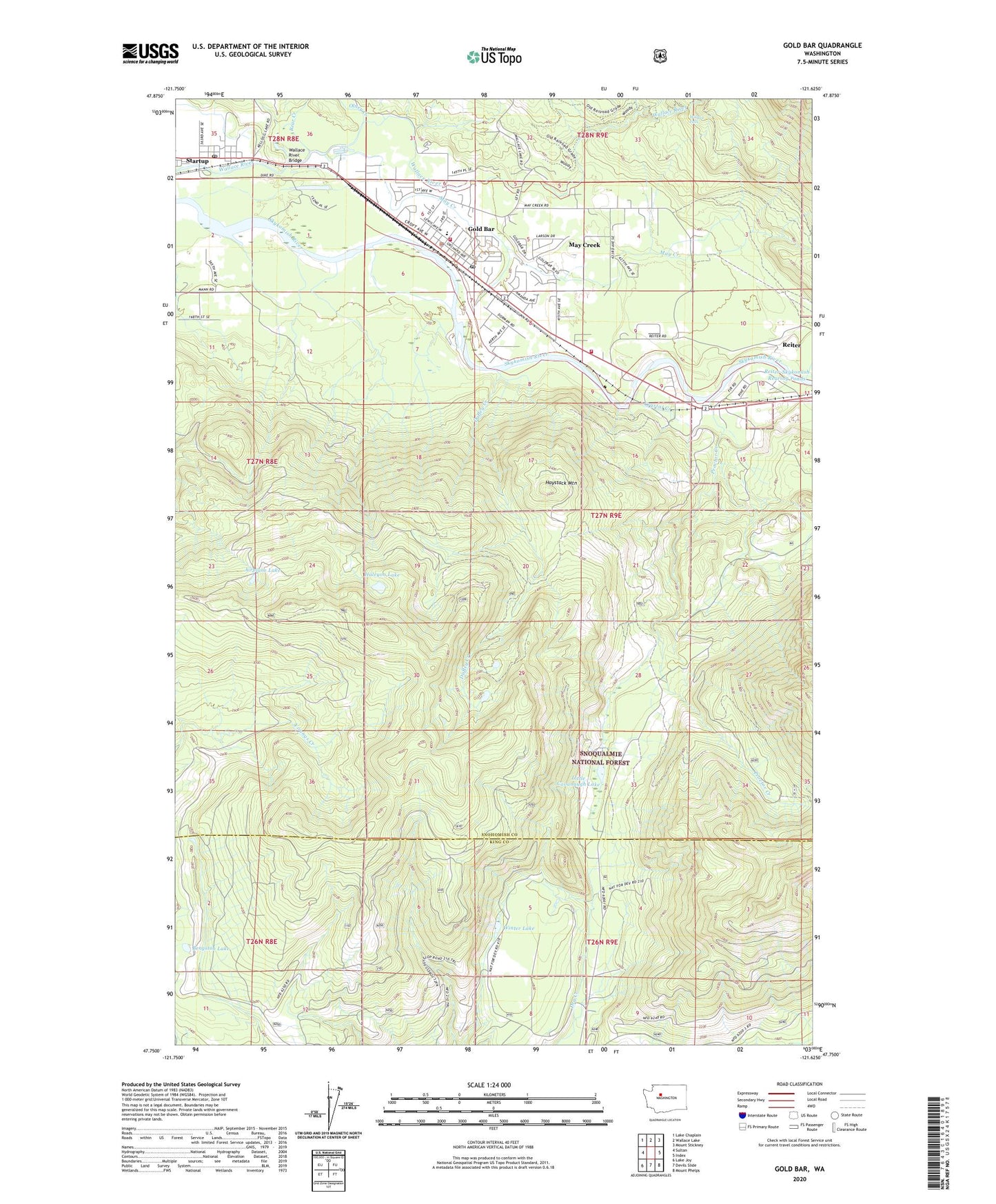
Gold Bar Washington US Topo Map
Couldn't load pickup availability
Also explore the Gold Bar Forest Service Topo of this same quad for updated USFS data
2023 topographic map quadrangle Gold Bar in the state of Washington. Scale: 1:24000. Based on the newly updated USGS 7.5' US Topo map series, this map is in the following counties: Snohomish, King. The map contains contour data, water features, and other items you are used to seeing on USGS maps, but also has updated roads and other features. This is the next generation of topographic maps. Printed on high-quality waterproof paper with UV fade-resistant inks.
Quads adjacent to this one:
West: Sultan
Northwest: Lake Chaplain
North: Wallace Lake
Northeast: Mount Stickney
East: Index
Southeast: Mount Phelps
South: Devils Slide
Southwest: Lake Joy
This map covers the same area as the classic USGS quad with code o47121g6.
Contains the following named places: Airplane Lake, Alpine Meadows Mobile Home Park, Bear Creek, Bengston Lake, Camp Huston, City of Gold Bar, Crystal Creek, Duffey Creek, Gold Bar, Gold Bar Elementary School, Gold Bar Post Office, Haleyon Lake, Haystack Mountain, Little Cavanaugh Lake, May Creek, May Creek Census Designated Place, McDaniels Mobile Village, North Fork Wallace River, Olney Creek, Proctor Creek, Reiter, Snohomish County Fire District 26 Station 53, Snohomish County Fire District 26 Station 54, Snohomish County Sheriff's Office Gold Bar, Startup, Startup Post Office, Wallace Falls, Wallace Falls State Park, Wallace River Bridge, Wallace River Mobile Home Park, Winter Lake