MyTopo
Sweetgrass Butte Washington US Topo Map
Couldn't load pickup availability
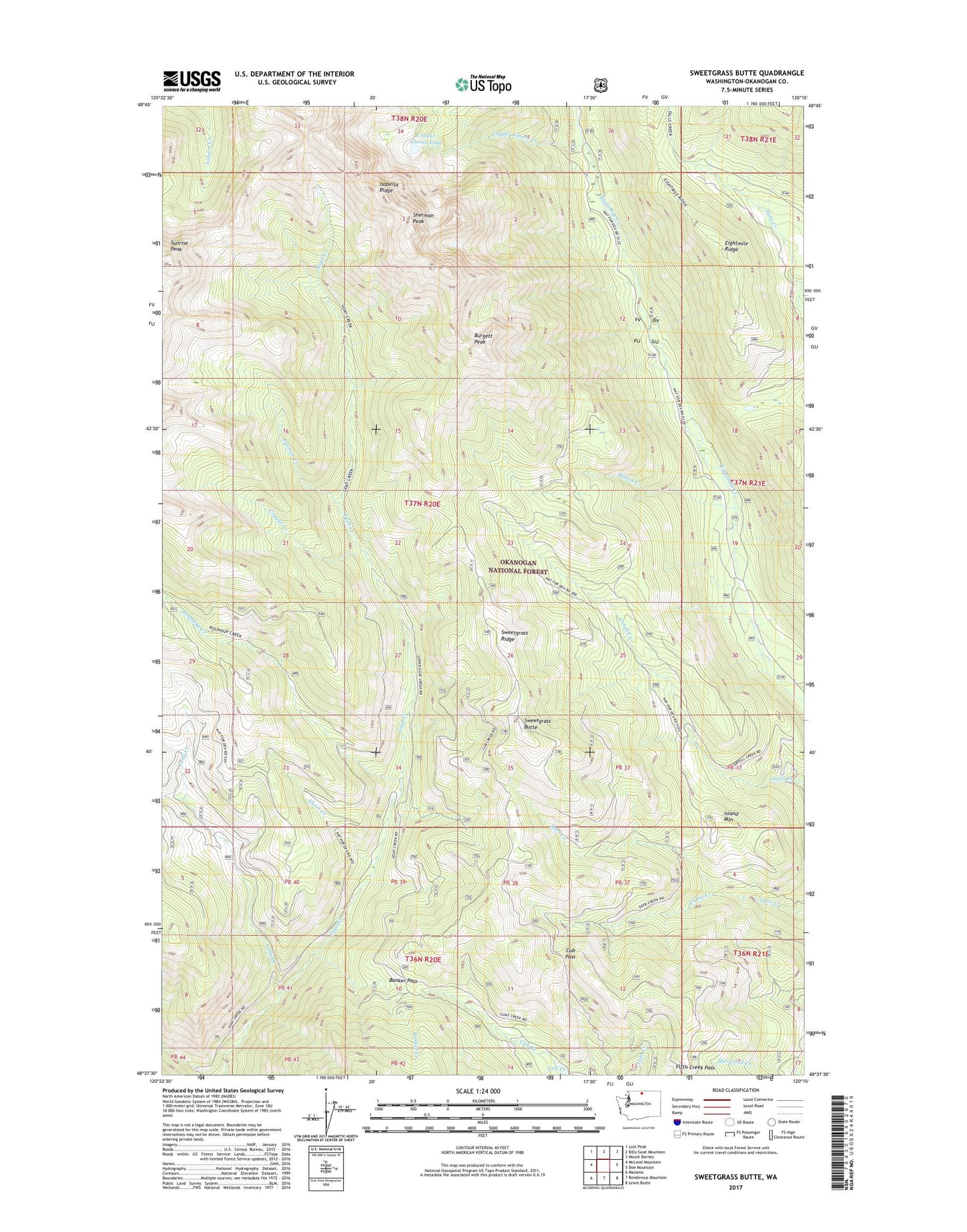
2020 topographic map quadrangle Sweetgrass Butte in the state of Washington. Scale: 1:24000. Based on the newly updated USGS 7.5' US Topo map series, this map is in the following counties: Okanogan. The map contains contour data, water features, and other items you are used to seeing on USGS maps, but also has updated roads and other features. This is the next generation of topographic maps. Printed on high-quality waterproof paper with UV fade-resistant inks.
Quads adjacent to this one:
West: McLeod Mountain
Northwest: Lost Peak
North: Billy Goat Mountain
Northeast: Mount Barney
East: Doe Mountain
Southeast: Lewis Butte
South: Rendevous Mountain
Southwest: Mazama
Contains the following named places: Banker Creek, Banker Pass, Burgett Peak, Button Creek, Cabin Creek, Calf Creek, Copper Glance Creek, Copper Glance Lake, Cougar Creek, Cub Pass, Eightmile Ridge, Falls Creek Trail, Fifth Creek Pass, Honeymoon Campground, Island Mountain, Long Creek, Panther Creek, Ray Creek, Roundup Creek, Ruffed Grouse Campground, Sherman Peak, Short Creek, Sunrise Peak, Sweetgrass Butte, Sweetgrass Ridge, Vanderpool Crossing, West Fork Long Creek