MyTopo
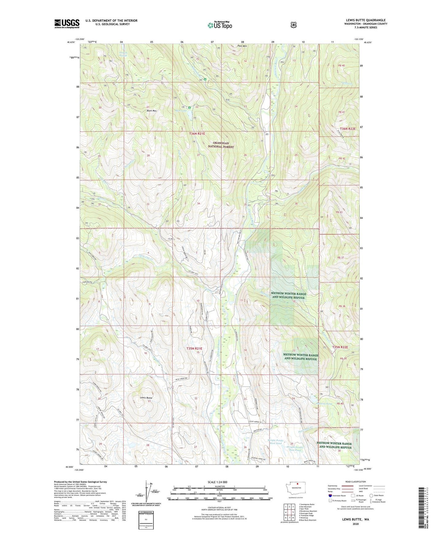
Lewis Butte Washington US Topo Map
Couldn't load pickup availability
Also explore the Lewis Butte Forest Service Topo of this same quad for updated USFS data
2023 topographic map quadrangle Lewis Butte in the state of Washington. Scale: 1:24000. Based on the newly updated USGS 7.5' US Topo map series, this map is in the following counties: Okanogan. The map contains contour data, water features, and other items you are used to seeing on USGS maps, but also has updated roads and other features. This is the next generation of topographic maps. Printed on high-quality waterproof paper with UV fade-resistant inks.
Quads adjacent to this one:
West: Rendevous Mountain
Northwest: Sweetgrass Butte
North: Doe Mountain
Northeast: Spur Peak
East: Pearrygin Peak
Southeast: Blue Buck Mountain
South: Winthrop
Southwest: Thompson Ridge
This map covers the same area as the classic USGS quad with code o48120e2.
Contains the following named places: Boulder Creek, Buck Lake, Buck Lake Campground, Buck Mountain, Cub Creek, Eightmile, Eightmile Creek, Eightmile Ranch, First Creek, Flat Campground, Lewis Butte, Little Cub Creek, Meadow Lake, Memorial Campground, Methow Valley Community School, Pete Creek, Ramsey Creek, Second Creek, Siegels Slough, Sullivan Pond, Third Creek, Valley Creek, Wright Ponds-East Pond, Wright Ponds-East Pond Dam, Wright Ponds-West Pond, Wright Ponds-West Pond Dam