MyTopo
Rendevous Mountain Washington US Topo Map
Couldn't load pickup availability
Also explore the Rendevous Mountain Forest Service Topo of this same quad for updated USFS data
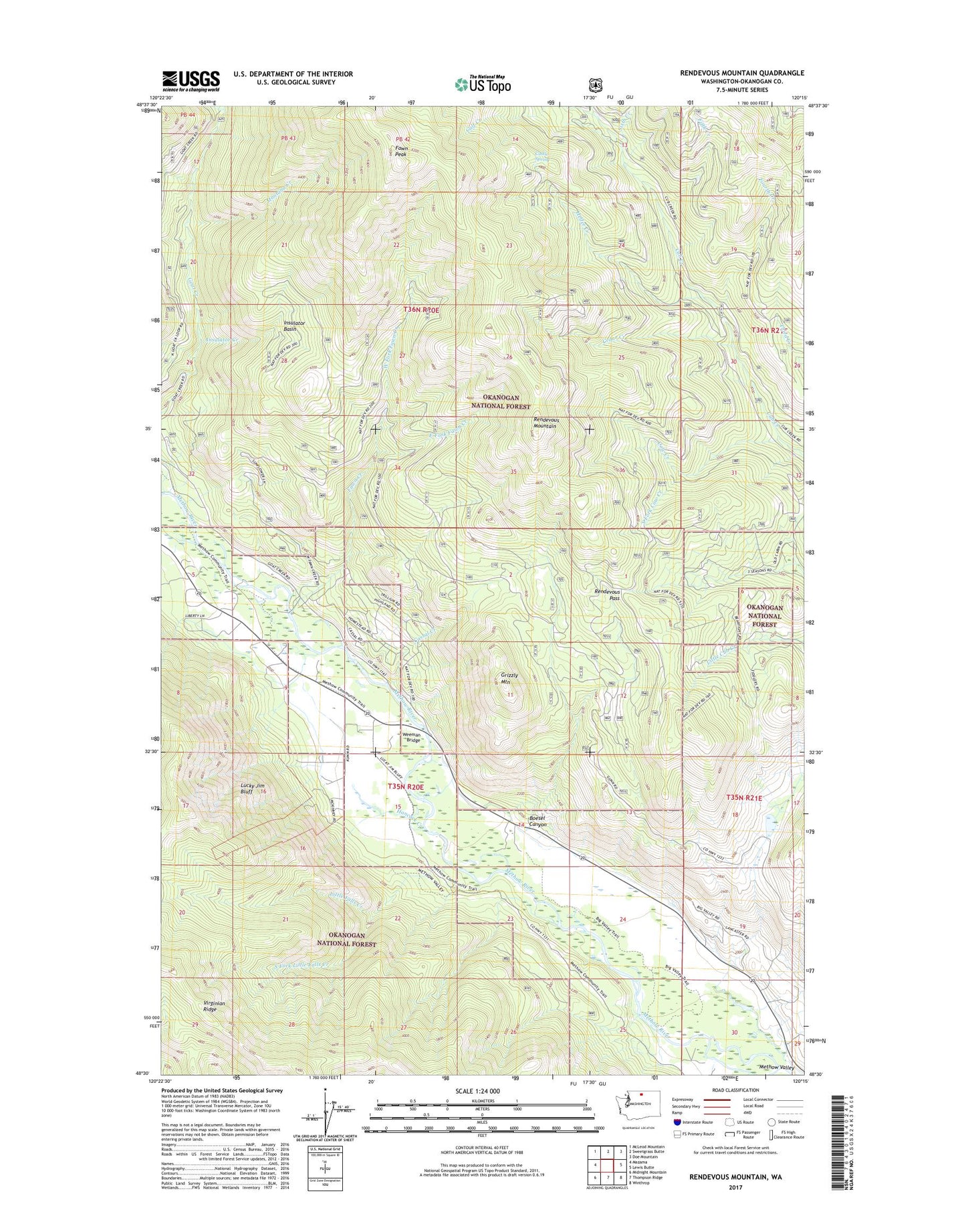
2023 topographic map quadrangle Rendevous Mountain in the state of Washington. Scale: 1:24000. Based on the newly updated USGS 7.5' US Topo map series, this map is in the following counties: Okanogan. The map contains contour data, water features, and other items you are used to seeing on USGS maps, but also has updated roads and other features. This is the next generation of topographic maps. Printed on high-quality waterproof paper with UV fade-resistant inks.
Quads adjacent to this one:
West: Mazama
Northwest: McLeod Mountain
North: Sweetgrass Butte
Northeast: Doe Mountain
East: Lewis Butte
Southeast: Winthrop
South: Thompson Ridge
Southwest: Midnight Mountain
This map covers the same area as the classic USGS quad with code o48120e3.
Contains the following named places: Boesel Canyon, Cassal Creek, Castle Spring, Cedar Creek, Cow Creek, East Fork Fawn Creek, Fawn Creek, Fawn Peak, Fifth Creek, Fourth Creek, Grizzly Mountain, Hancock Creek, Heifer Creek, Insulator Basin, Insulator Creek, Little Falls Creek, Lucky Jim Bluff, Mazama Camp, Mazama Community Church, Montana Creek, Montana Mine, Rendevous Mountain, Rendevous Pass, Sixth Creek, South Fork Cow Creek, South Fork Little Falls Creek, Weeman Bridge, West Fork Fawn Creek, Whiteface Creek, ZIP Code: 98862