MyTopo
Ashnola Mountain Washington US Topo Map
Couldn't load pickup availability
Also explore the Ashnola Mountain Forest Service Topo of this same quad for updated USFS data
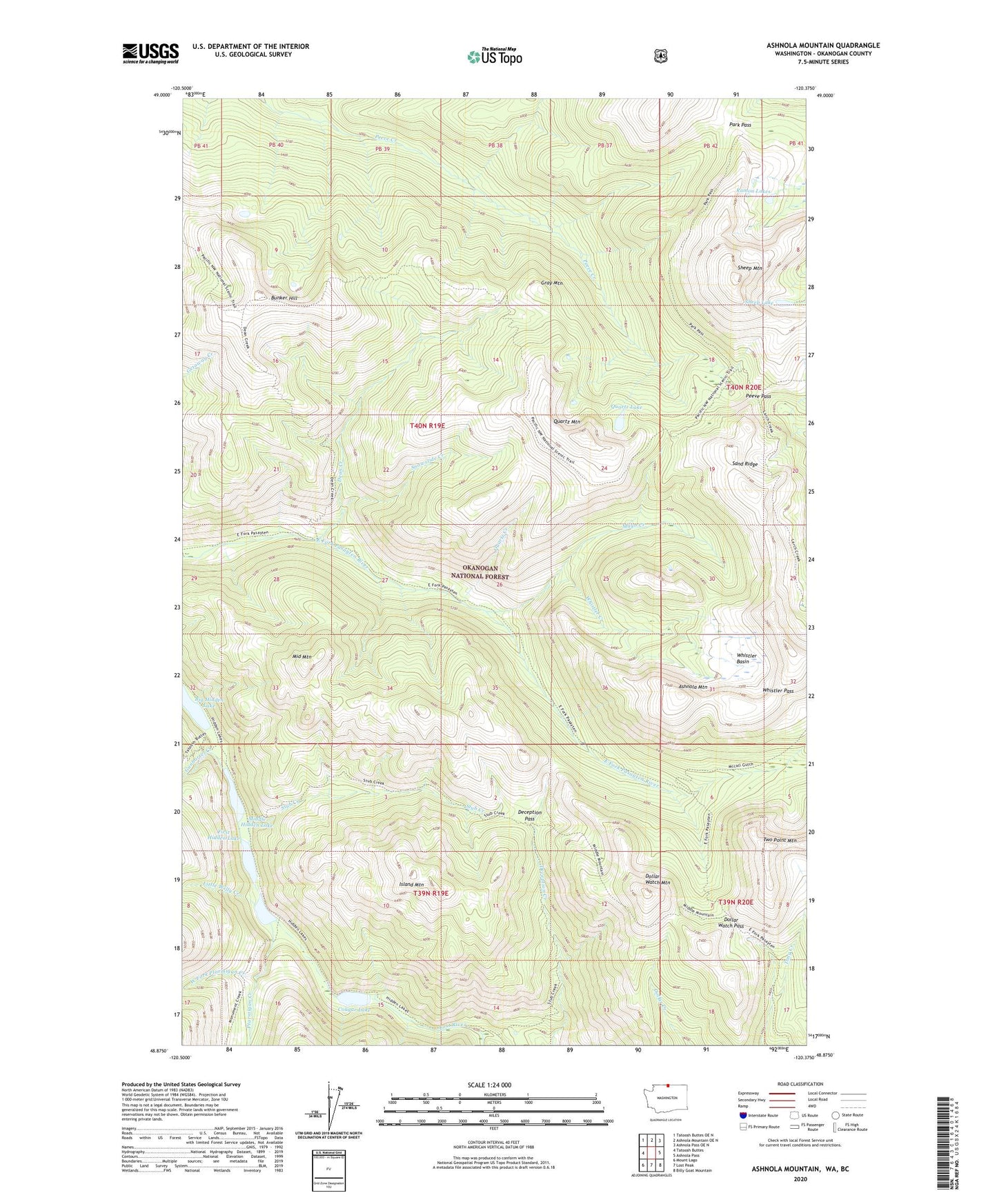
2023 topographic map quadrangle Ashnola Mountain in the state of Washington. Scale: 1:24000. Based on the newly updated USGS 7.5' US Topo map series, this map is in the following counties: Okanogan. The map contains contour data, water features, and other items you are used to seeing on USGS maps, but also has updated roads and other features. This is the next generation of topographic maps. Printed on high-quality waterproof paper with UV fade-resistant inks.
Quads adjacent to this one:
West: Tatoosh Buttes
Northwest: Tatoosh Buttes OE N
North: Ashnola Mountain OE N
Northeast: Ashnola Pass OE N
East: Ashnola Pass
Southeast: Billy Goat Mountain
South: Lost Peak
Southwest: Mount Lago
This map covers the same area as the classic USGS quad with code o48120h4.
Contains the following named places: Ashnola Mountain, Boundary Trail, Bunker Hill, Cougar Lake, Dean Creek, Deception Pass, Dollar Watch Mountain, Dollar Watch Pass, First Hidden Lake, Gray Mountain, Gunbarrel Creek, Hidden Lakes, Island Lake, Island Mountain, Little Willy Creek, Mayo Creek, McCall Gulch, Middle Hidden Lake, Middle Mountain, Murphy Creek, Park Pass, Peeve Pass, Ptarmigan Creek, Quartz Creek, Quartz Lake, Quartz Mountain, Ramon Lakes, Sand Ridge, Sheep Lake, Sheep Mountain, Snowslide Creek, Stub Creek, Two Point Mountain, West Fork Ptarmigan Creek, Whistler Basin, Whistler Creek, Whistler Pass