MyTopo
Tieton Basin Washington US Topo Map
Couldn't load pickup availability
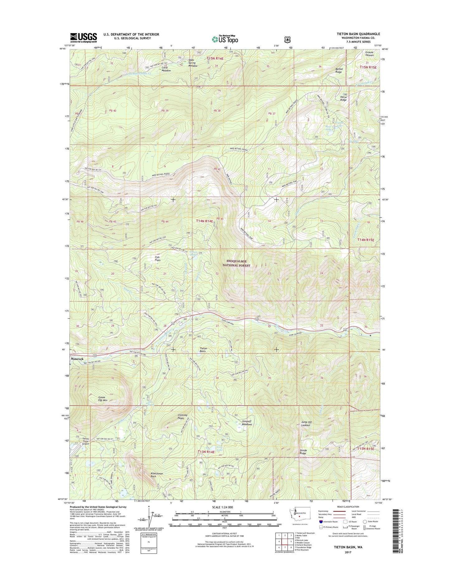
2020 topographic map quadrangle Tieton Basin in the state of Washington. Scale: 1:24000. Based on the newly updated USGS 7.5' US Topo map series, this map is in the following counties: Yakima. The map contains contour data, water features, and other items you are used to seeing on USGS maps, but also has updated roads and other features. This is the next generation of topographic maps. Printed on high-quality waterproof paper with UV fade-resistant inks.
Quads adjacent to this one:
West: Rimrock Lake
Northwest: Timberwolf Mountain
North: Meeks Table
Northeast: Nile
East: Weddle Canyon
Southeast: Pine Mountain
South: Foundation Ridge
Southwest: Darland Mountain
Contains the following named places: Bear Lake, Bear Lake Campground, Bethel Ridge, Cabin Creek, Chimney Peaks, Coral Meadow, Fish Flats, Goose Egg Mountain, Hause Creek, Hause Creek Campground, Horse Ridge, Jump Off Lookout, Jumpoff Meadows, Kloochman Rock, Lost Lake, Lost Lake Campground, Lynne Lake, Milk Creek, Pine Creek, River Bend Campground, Soda Spring, Soda Spring Meadow, Soup Creek, Tieton Basin, Tieton Pond, Tieton Ranger Station, Tieton State Airport, Tieton Work Center, Ty Lake, Wild Rose Campground, Wildcat Creek, Willows Campground