MyTopo
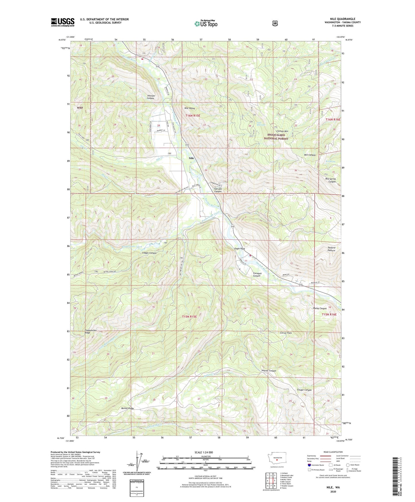
Nile Washington US Topo Map
Couldn't load pickup availability
Also explore the Nile Forest Service Topo of this same quad for updated USFS data
2023 topographic map quadrangle Nile in the state of Washington. Scale: 1:24000. Based on the newly updated USGS 7.5' US Topo map series, this map is in the following counties: Yakima. The map contains contour data, water features, and other items you are used to seeing on USGS maps, but also has updated roads and other features. This is the next generation of topographic maps. Printed on high-quality waterproof paper with UV fade-resistant inks.
Quads adjacent to this one:
West: Meeks Table
Northwest: Cliffdell
North: Manastash Lake
Northeast: Hudson Creek
East: Milk Canyon
Southeast: Tieton
South: Weddle Canyon
Southwest: Tieton Basin
This map covers the same area as the classic USGS quad with code o46120g8.
Contains the following named places: Benton Creek, Box Spring, Carmack Canyon, Carrol Flats, Cheney Ranch, Dry Creek, Eagle Rock, Garrett Canyon, Hanging Tree Campground, Johnson Canyon, Little Mud Lake, Little Rattlesnake Creek, Logger Canyon, Meloy Canyon, Nile, Nile Census Designated Place, Nile Community Church, Nile Creek, Rattlesnake Creek, Rattlesnake Ranger Station, Sanford Pasture, Yakima County Fire District 14 Nile - Cliffdell Fire - Rescue Department Station 10 Gold Creek, Yakima County Fire District 14 Nile - Cliffdell Fire - Rescue Department Station 12