MyTopo
Vulcan Mountain Washington US Topo Map
Couldn't load pickup availability
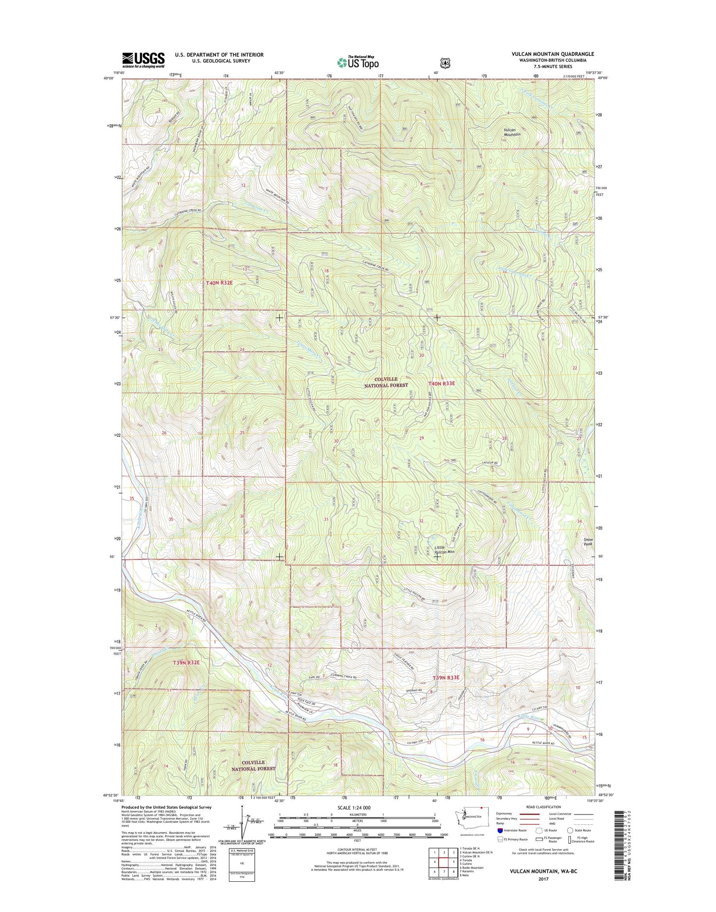
2020 topographic map quadrangle Vulcan Mountain in the state of Washington. Scale: 1:24000. Based on the newly updated USGS 7.5' US Topo map series, this map is in the following counties: Ferry. The map contains contour data, water features, and other items you are used to seeing on USGS maps, but also has updated roads and other features. This is the next generation of topographic maps. Printed on high-quality waterproof paper with UV fade-resistant inks.
Quads adjacent to this one:
West: Toroda
Northwest: Toroda OE N
North: Vulcan Mountain OE N
Northeast: Curlew OE N
East: Curlew
Southeast: Malo
South: Karamin
Southwest: Bodie Mountain
Contains the following named places: Bamber Creek, Cottonwood Creek, Emanuel Creek, Henry Creek, Little Vulcan Mountain, Snow Peak, Tonata Creek, Vulcan Lookout, Vulcan Mountain, ZIP Code: 99118