MyTopo
Whitstran Washington US Topo Map
Couldn't load pickup availability
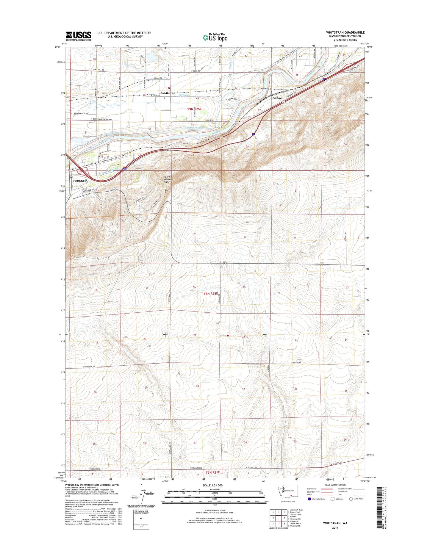
2023 topographic map quadrangle Whitstran in the state of Washington. Scale: 1:24000. Based on the newly updated USGS 7.5' US Topo map series, this map is in the following counties: Benton. The map contains contour data, water features, and other items you are used to seeing on USGS maps, but also has updated roads and other features. This is the next generation of topographic maps. Printed on high-quality waterproof paper with UV fade-resistant inks.
Quads adjacent to this one:
West: Prosser
Northwest: Sagebrush Ridge
North: Snipes Creek
Northeast: Corral Canyon
East: Whitstran NE
Southeast: Whitstran SE
South: Lenzie Ranch
Southwest: Prosser SE
This map covers the same area as the classic USGS quad with code o46119b6.
Contains the following named places: Benton County Fire Protection District 5 Station 530, Biggam, Chandler Canal, Davis Ranch, Gibbon, Prosser East Lateral, Prosser Fire District 3 Station 320, Snipes Creek, Spring Creek, Whitstran, ZIP Code: 99350