MyTopo
Wildwood Washington US Topo Map
Couldn't load pickup availability
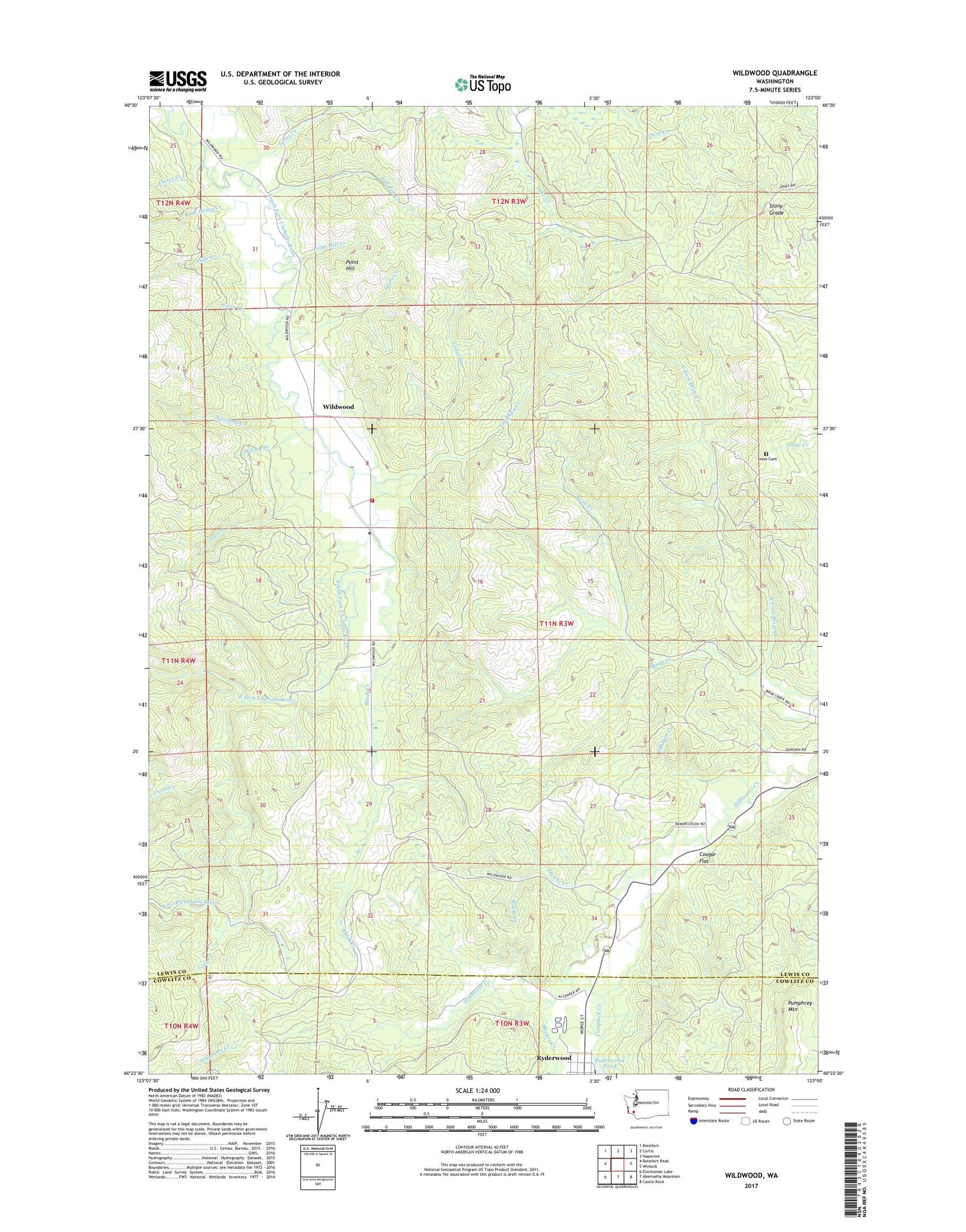
2020 topographic map quadrangle Wildwood in the state of Washington. Scale: 1:24000. Based on the newly updated USGS 7.5' US Topo map series, this map is in the following counties: Lewis, Cowlitz. The map contains contour data, water features, and other items you are used to seeing on USGS maps, but also has updated roads and other features. This is the next generation of topographic maps. Printed on high-quality waterproof paper with UV fade-resistant inks.
Quads adjacent to this one:
West: Boistfort Peak
Northwest: Boistfort
North: Curtis
Northeast: Napavine
East: Winlock
Southeast: Castle Rock
South: Abernathy Mountain
Southwest: Elochoman Lake
Contains the following named places: Banks Creek, Becker Creek, Black Creek, Bull Pen Creek, Campbell Creek, Cedar Creek, Cougar Flat, Deer Creek, Foster Creek, Hogan Creek, Laughlin Creek, Lentz Creek, Lewis County Fire District 13 Station 3, Newland Creek, North Fork Brim Creek, Owens Creek, Point Hill, Point Hill Creek, Root House Creek, Ryderwood, Sears Creek, Sep Creek, Slide Creek, Snow Cemetery, Stony Grade, Trout Creek, Water Creek, Wildwood, Wilson Creek, ZIP Code: 98593