MyTopo
Curtis Washington US Topo Map
Couldn't load pickup availability
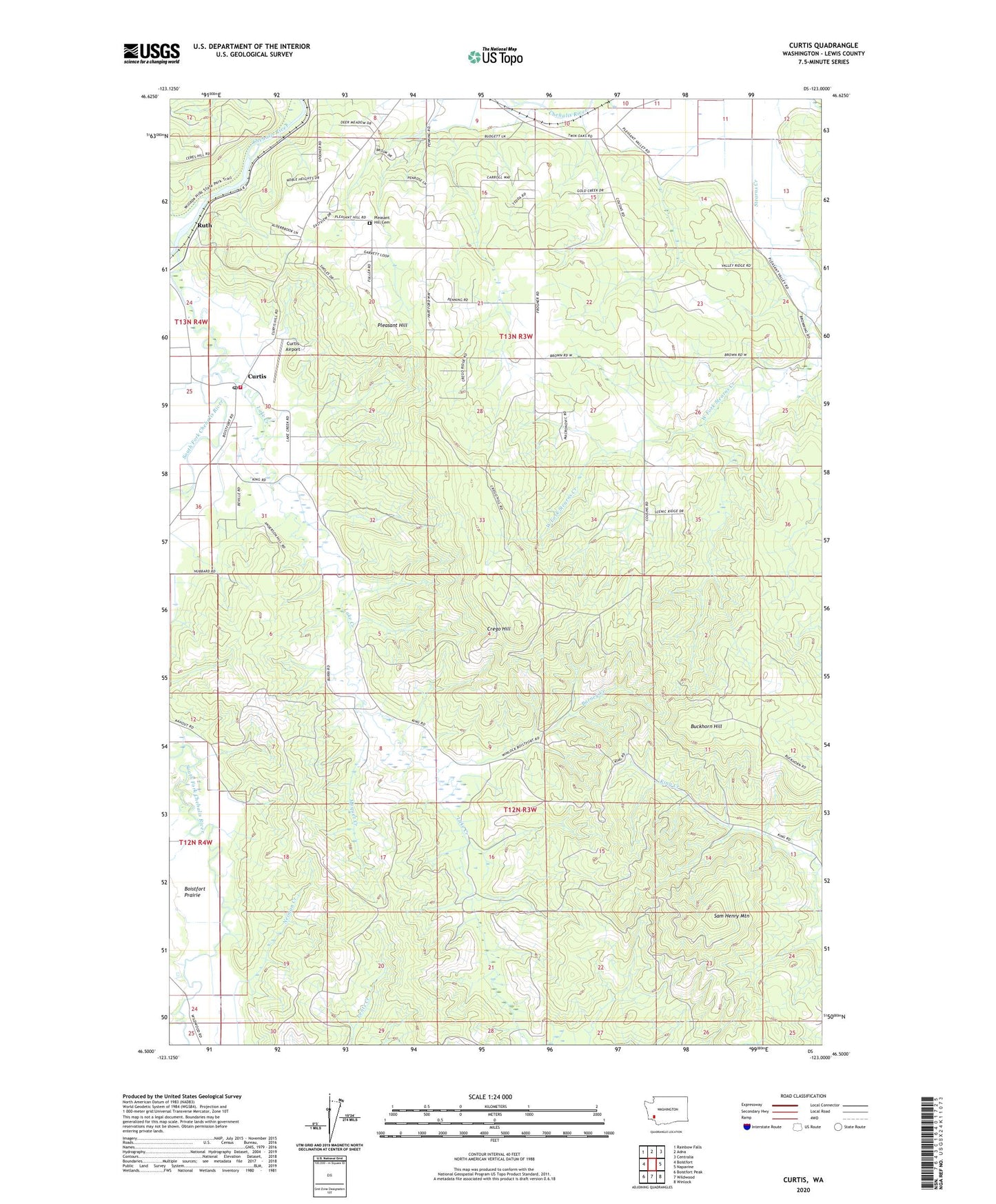
2023 topographic map quadrangle Curtis in the state of Washington. Scale: 1:24000. Based on the newly updated USGS 7.5' US Topo map series, this map is in the following counties: Lewis. The map contains contour data, water features, and other items you are used to seeing on USGS maps, but also has updated roads and other features. This is the next generation of topographic maps. Printed on high-quality waterproof paper with UV fade-resistant inks.
Quads adjacent to this one:
West: Boistfort
Northwest: Rainbow Falls
North: Adna
Northeast: Centralia
East: Napavine
Southeast: Winlock
South: Wildwood
Southwest: Boistfort Peak
This map covers the same area as the classic USGS quad with code o46123e1.
Contains the following named places: Barney Creek, Buckhorn Hill, Crego, Crego Grange, Crego Hill, Curtis, Curtis Airport, Curtis Post Office, Deep Creek, Follette Dam, KCKA-TV (Centralia), KMNT-FM (Centralia), Lake Creek, Lewis County Fire District 13 Station 2, Moquet Creek, Neiman Creek, Pleasant Hill, Pleasant Hill Cemetery, Ruth, Sam Henry Mountain, South Fork Chehalis River