
MyTopo
Adrian West Virginia US Topo Map
Couldn't load pickup availability
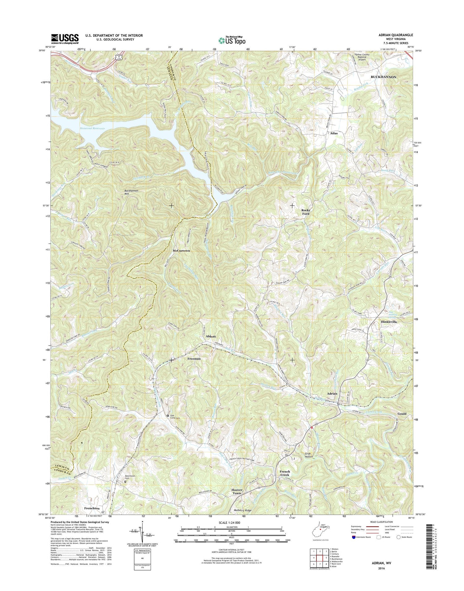
2019 topographic map quadrangle Adrian in the state of West Virginia. Scale: 1:24000. Based on the newly updated USGS 7.5' US Topo map series, this map is in the following counties: Upshur, Lewis. The map contains contour data, water features, and other items you are used to seeing on USGS maps, but also has updated roads and other features. This is the next generation of topographic maps. Printed on high-quality waterproof paper with UV fade-resistant inks.
Quads adjacent to this one:
West: Roanoke
Northwest: Weston
North: Berlin
Northeast: Century
East: Buckhannon
Southeast: Alton
South: Rock Cave
Southwest: Walkersville
Contains the following named places: Abbott, Adrian, Adrian Census Designated Place, Adrian Post Office, Adrian Volunteer Fire Department, Atlas, Bear Run, Beaver Run, Beechlick Run, Beechtown Cemetery, Blacklick Run, Brush Run, Brushlick Run, Brushy Fork, Brushy Fork Seventh Day Adventist School, Buckhannon District, Buckhannon Mountain, Bull Run, Bull Run School, Cleavenger School, Crooked Run, Day Helmick Spring, Fall Run, First District, Freeman, French Creek, French Creek Elementary School, French Creek Post Office, French Creek Presbyterian Church, Frenchton Post Office, Glady Fork, Glady School, Gould, Grand Camp Run, Grub Hollow, Hinkleville, Hinkleville Census Designated Place, Hoover Town, Kittle Run, Laurel Fork, Lebanon Church, Lick Run, Little Brush Run, Log Hollow Run, Lower Brushy Fork School, McCuetown, Miller Crossing, Morgan Run, Mount Olive Church, Mudlick Run, New Found Run, Oak Grove School, Pigeonroost Run, Pleasant Dale Church, Point Pleasant Church, Pringle Fork, Reger Chapel, Rocky Ford, Slab Camp Cemetery, Slab Camp Fork, Slab Camp School, Snyder Run, Snyder School, Spruce Fork, Spruce Fork Church, Stonecoal Lake Wildlife Management Area, Stonecoal Reservoir, Straight Run, Upshur County Regional Airport, Willow Brook School, Wilson Siding, Wolfpen Run, ZIP Code: 26372


