MyTopo
Rock Cave West Virginia US Topo Map
Couldn't load pickup availability
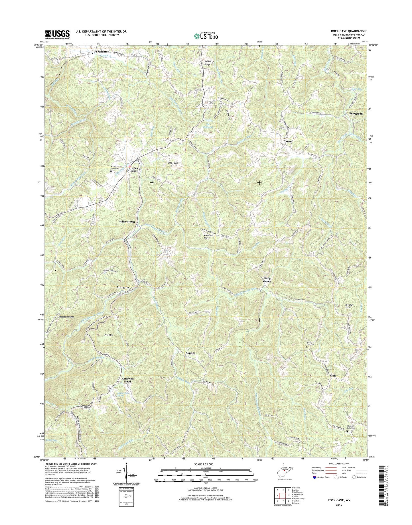
2023 topographic map quadrangle Rock Cave in the state of West Virginia. Scale: 1:24000. Based on the newly updated USGS 7.5' US Topo map series, this map is in the following counties: Upshur. The map contains contour data, water features, and other items you are used to seeing on USGS maps, but also has updated roads and other features. This is the next generation of topographic maps. Printed on high-quality waterproof paper with UV fade-resistant inks.
Quads adjacent to this one:
West: Walkersville
Northwest: Roanoke
North: Adrian
Northeast: Buckhannon
East: Alton
Southeast: Pickens
South: Goshen
Southwest: Hacker Valley
This map covers the same area as the classic USGS quad with code o38080g3.
Contains the following named places: Arlington, Banks District, Banks District Volunteer Fire Department, Bethlehem Church, Big Run Knob, Bob Peak, Buttonwood Run, Carter, Center Chapel, Cow Run, Crooked Run, Cub Run, Evergreen, Fall Run, Flatwoods Run, French Creek Game Farm, Frenchton, Gaines, Getout Run, Grassy Creek, Heaston Ridge, Heaston School, Holly Grove, Joes Run, Kanawha Chapel Church, Kanawha Head, Kanawha Head Post Office, Kanawha Run, Kanawha Run Church, Kanawha Run School, Knabenshue School, Laurel Park Church, Laurel Run, Left Fork French Creek, Lower Laurel Fork School, Lynn Camp Run, Magnolia School, McDavidson Spring, Meade District, Mount Zion Cemetery, Mount Zion Church, Mulberry Ridge, Mulberry Ridge School, Oak Grove Church, Oak Grove School, Pleasant Dale Cemetery, Pleasant Dale Church, Pleasant Ridge, Pleasant Ridge School, Prit Mountain, Providence Church, Queens Fork, Rich Run, Rock Cave, Rock Cave Cemetery, Rock Cave Census Designated Place, Rock Cave Elementary School, Rock Cave Post Office, Salem Church, Salem School, Sand Run, Seng Run, Shinar School, Straight Fork, The Fishpond, Third District, Waterloo Church, West Virginia Division of Forestry Upshur County Field Office, Whites Camp Fork, Wilson Chapel, Wilsontown, Zion, Zion School, ZIP Codes: 26218, 26228, 26234