MyTopo
Berlin West Virginia US Topo Map
Couldn't load pickup availability
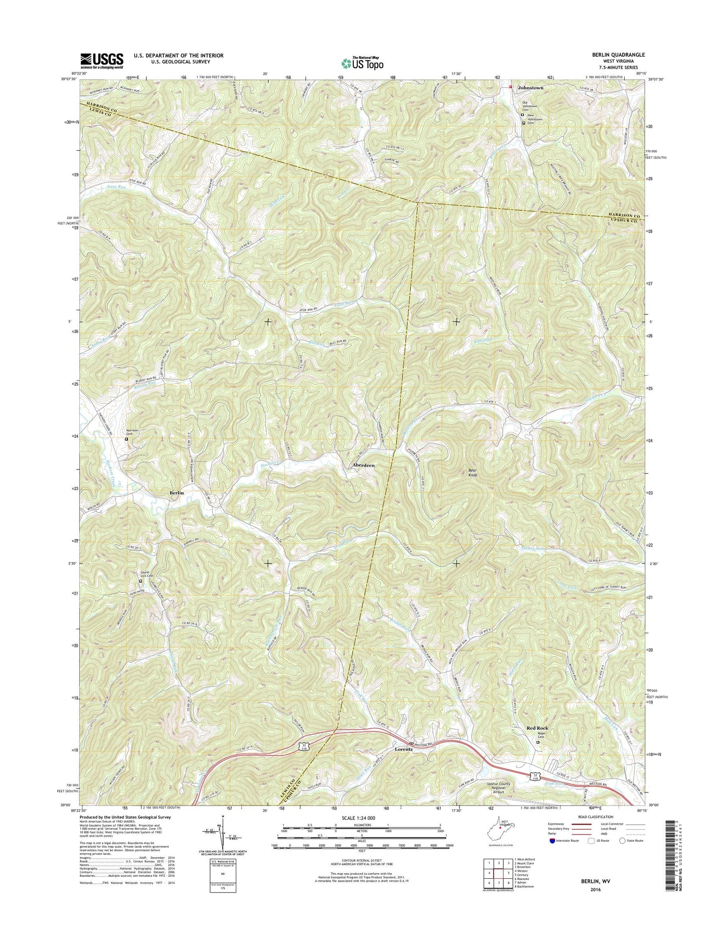
2023 topographic map quadrangle Berlin in the state of West Virginia. Scale: 1:24000. Based on the newly updated USGS 7.5' US Topo map series, this map is in the following counties: Lewis, Upshur, Harrison. The map contains contour data, water features, and other items you are used to seeing on USGS maps, but also has updated roads and other features. This is the next generation of topographic maps. Printed on high-quality waterproof paper with UV fade-resistant inks.
Quads adjacent to this one:
West: Weston
Northwest: West Milford
North: Mount Clare
Northeast: Brownton
East: Century
Southeast: Buckhannon
South: Adrian
Southwest: Roanoke
This map covers the same area as the classic USGS quad with code o39080a3.
Contains the following named places: Aberdeen, Bear Knob, Berlin, Bills Lick, Blake School, Bloody Run, Bridge Run, Bridge Run School, Buckhannon Run, Buckhannon Run Church, Buckhannon Run School, Bull Lick, Frog Run, Jesse Run Cemetery, Jesse Run Church, Johnstown, Johnstown United Methodist Church, Johnstown Volunteer Fire Department, Laurel Lick, Laurel Lick Cemetery, Laurel Lick Church, Lorentz, Lorentz Methodist Protestant Church, Lorentz Post Office, Mick Hill School, Morrison Cemetery, Mud Lick, Mudlick School, New Johnstown Cemetery, Old Johnstown Cemetery, Red Rock, Reger Cemetery, Rooting Creek School, Sauls Run, Upper Jesse Run School, Valley Chapel, Walnut Grove School, Wash Run, WBUC-AM (Buckhannon), White Oak, White Oak Grove School, Whiteoak Grove School