MyTopo
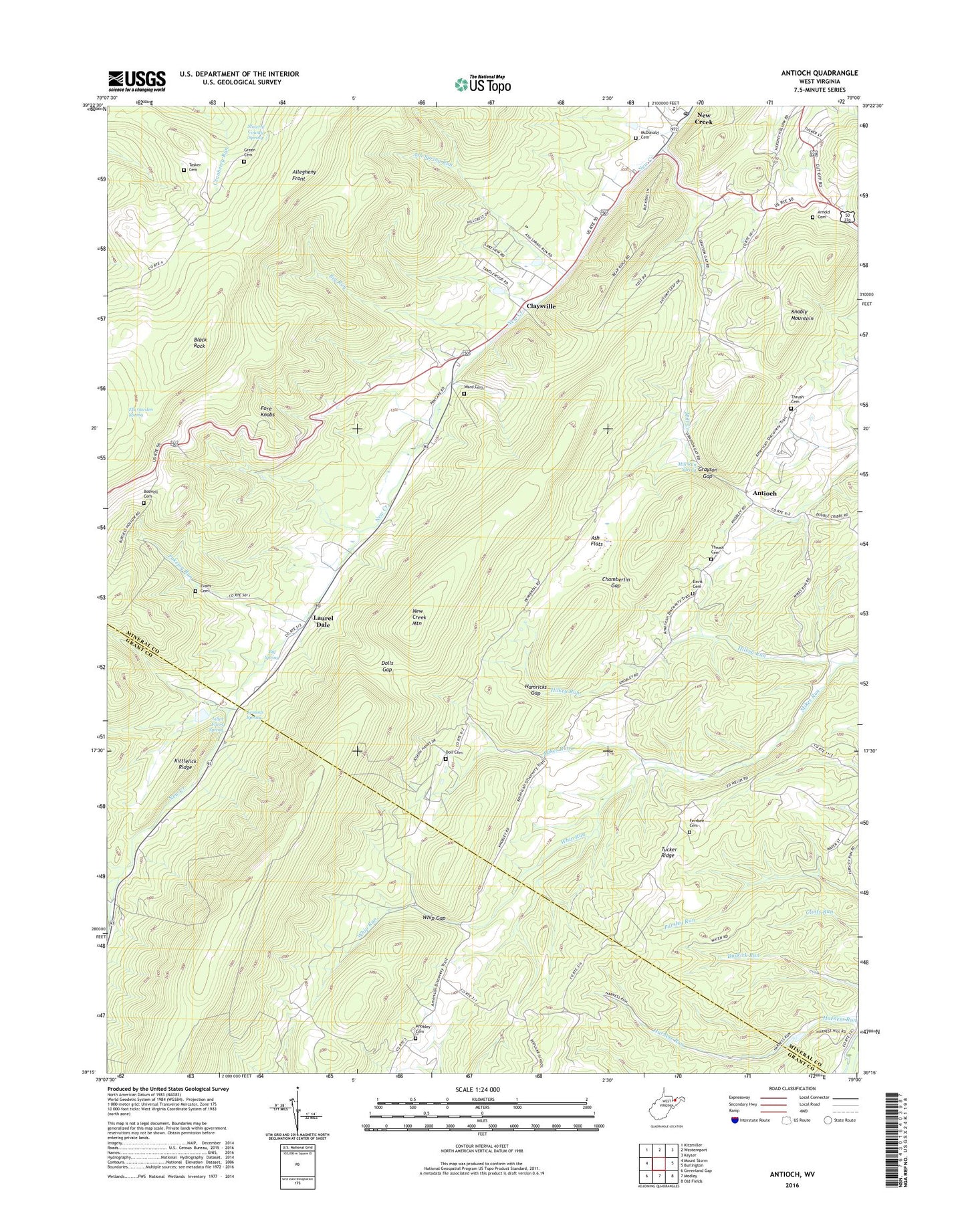
Antioch West Virginia US Topo Map
Couldn't load pickup availability
2019 topographic map quadrangle Antioch in the state of West Virginia. Scale: 1:24000. Based on the newly updated USGS 7.5' US Topo map series, this map is in the following counties: Mineral, Grant. The map contains contour data, water features, and other items you are used to seeing on USGS maps, but also has updated roads and other features. This is the next generation of topographic maps. Printed on high-quality waterproof paper with UV fade-resistant inks.
Quads adjacent to this one:
West: Mount Storm
Northwest: Kitzmiller
Northeast: Keyser
East: Burlington
Southeast: Old Fields
South: Medley
Southwest: Greenland Gap
Contains the following named places: Antioch, Arnold Cemetery, Ash Flat School, Ash Flats, Ash Spring Run, Big Run, Big Spring, Black Rock, Boswell Cemetery, Chamberlin Gap, Claysville, Claysville Church, Davis Cemetery, Doll Cemetery, Dolls Gap, Elk Garden Spring, Evans Cemetery, Ferrbee Cemetery, Grayson Gap, Green Cemetery, Hamricks Gap, Harness School, Hilkey Run, Kittlelick Ridge, Knobley Cemetery, Knobly Church, Knobly Mountain, Knobly School, Laurel Dale, Lemons Spring, Liller Farm Spring, Linton Creek, McDonald Cemetery, Mikes Run School, Mill Run Spring, Mineral County Spring, Mountain Valley School, Nancy Hanks Memorial, New Creek Post Office, New Creek Primary School, New Creek Site 10 Dam, New Creek Structure 12 Dam, New Creek Structure 17 Dam, New Creek Structure Seven Dam, Patterson Creek Structure 14 Dam, Pokejoy Run, Rees Chapel United Methodist Church, Sunnyside Church, Sunnyside School, Tasker Cemetery, Thrush Cemetery, Tucker Ridge, Ward Cemetery, Whip Gap, Whip Run, ZIP Code: 26743