MyTopo
Greenland Gap West Virginia US Topo Map
Couldn't load pickup availability
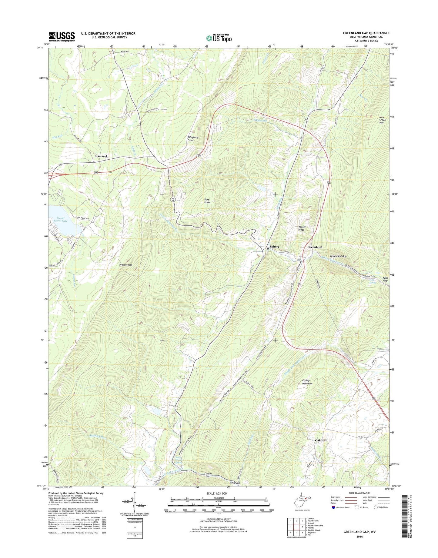
2023 topographic map quadrangle Greenland Gap in the state of West Virginia. Scale: 1:24000. Based on the newly updated USGS 7.5' US Topo map series, this map is in the following counties: Grant. The map contains contour data, water features, and other items you are used to seeing on USGS maps, but also has updated roads and other features. This is the next generation of topographic maps. Printed on high-quality waterproof paper with UV fade-resistant inks.
Quads adjacent to this one:
West: Mount Storm Lake
Northwest: Gorman
North: Mount Storm
Northeast: Antioch
East: Medley
Southeast: Rig
South: Maysville
Southwest: Blackbird Knob
This map covers the same area as the classic USGS quad with code o39079b2.
Contains the following named places: Allegheny Church of the Brethren, Allegheny Front, Bismarck, Brick Church, Brick Church Spring, Cold Spring, Cosner Gap, Elklick Run, Excelsior School, Fore Knobs, Forest Hill School, Grassy Ridge School, Greenland, Greenland Gap, Laurel Run, Little Creek, Little Creek School, Locust Grove Church, Lunice Creek Structure Number 10 Dam, Lunice Creek Structure Number 11 Dam, Mount Storm Heliport, Mount Storm Power Station Dam, New Creek Mountain, Oak Hill, Oak Hill School, Oakdale Church, Oakdale School, Patterson Creek Structure Number Six Dam, Pigeon Roost Lookout Tower, Pigeonroost, Saltblock Run, Scherr, Scherr Post Office, Shell Run, Walker Ridge, ZIP Code: 26739