MyTopo
Old Fields West Virginia US Topo Map
Couldn't load pickup availability
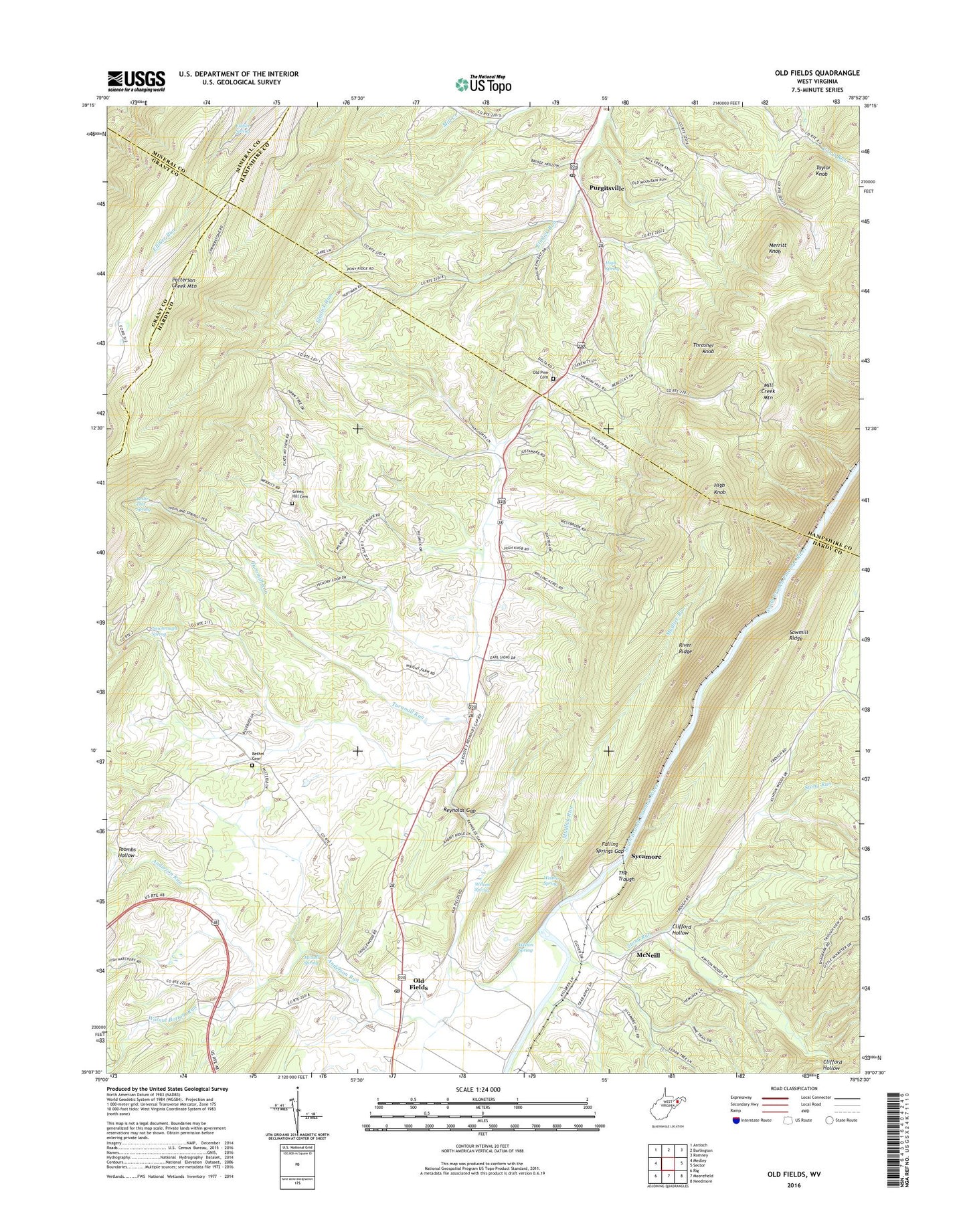
2023 topographic map quadrangle Old Fields in the state of West Virginia. Scale: 1:24000. Based on the newly updated USGS 7.5' US Topo map series, this map is in the following counties: Hardy, Hampshire, Grant, Mineral. The map contains contour data, water features, and other items you are used to seeing on USGS maps, but also has updated roads and other features. This is the next generation of topographic maps. Printed on high-quality waterproof paper with UV fade-resistant inks.
Quads adjacent to this one:
West: Medley
Northwest: Antioch
North: Burlington
Northeast: Romney
East: Sector
Southeast: Needmore
South: Moorefield
Southwest: Rig
This map covers the same area as the classic USGS quad with code o39078b8.
Contains the following named places: Anderson Run, Bethel Cemetery, Bethel Church, Bethel School, Clifford Hollow, Elliber Spring, Falling Springs Gap, Flats, Green Hill Cemetery, High Knob, High Spring, Leslie This Spring, Marvin Chapel, McNeil Spring, McNeill, Merritt Knob, Mill Creek Elementary School, Mount View School, Mudlick Run, New Lane School, Newbrough Spring, Old Fields, Old Fields Church, Old Fields Church Cemetery, Old Fields District, Old Fields Post Office, Old Fields School, Old Pine Cemetery, Old Pine Church, Otterdin Church, Patterson Creek Mountain, Powder Lick School, Purgitsville, Purgitsville Post Office, Reynolds Gap, River Ridge, Sawmill Ridge, South Branch Wildlife Management Area, Stony Run, Sycamore, Taylor Knob, Thrasher Knob, Thrasher Spring School, Toombs Hollow, Turnmill Run, Twin Mountain, Walnut Bottom Run, Welton Spring, ZIP Codes: 26845, 26852