MyTopo
Arlee West Virginia US Topo Map
Couldn't load pickup availability
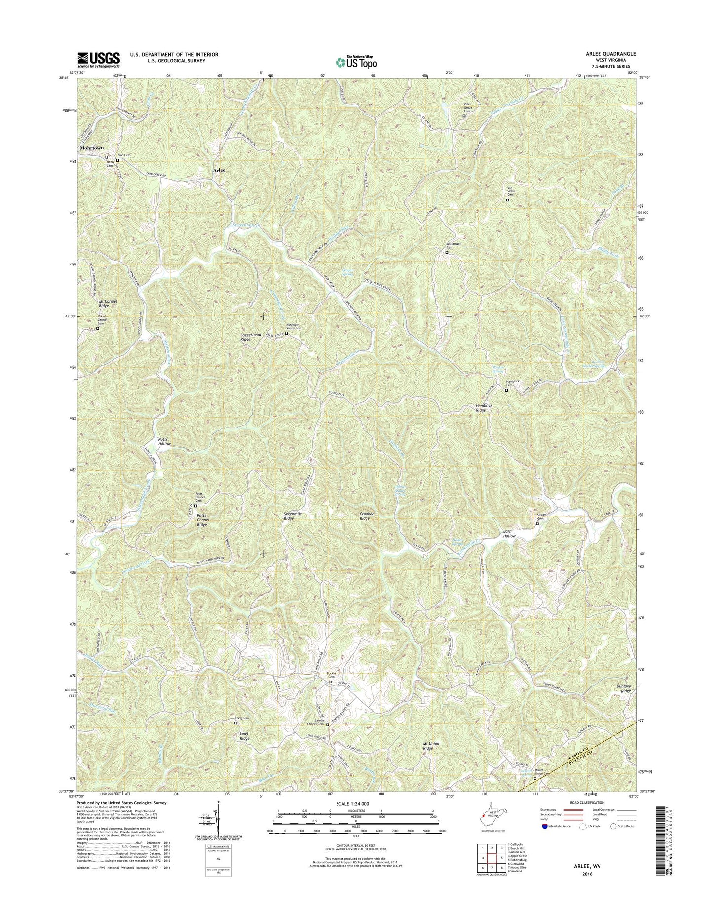
2023 topographic map quadrangle Arlee in the state of West Virginia. Scale: 1:24000. Based on the newly updated USGS 7.5' US Topo map series, this map is in the following counties: Mason, Putnam. The map contains contour data, water features, and other items you are used to seeing on USGS maps, but also has updated roads and other features. This is the next generation of topographic maps. Printed on high-quality waterproof paper with UV fade-resistant inks.
Quads adjacent to this one:
West: Apple Grove
Northwest: Gallipolis
North: Beech Hill
Northeast: Mount Alto
East: Robertsburg
Southeast: Winfield
South: Mount Olive
Southwest: Glenwood
This map covers the same area as the classic USGS quad with code o38082f1.
Contains the following named places: Arbuckle District, Arlee, Balcott Spring, Barn Hollow, Barrs Chapel, Barton Chapel, Barton Chapel Cemetery, Buckle Cemetery, Buckle School, Charles Angles Spring, Chief Cornstalk Headquarters, Chief Cornstalk Wildlife Management Area, Clendenin District, Condee, Crooked Ridge, Dunlavy Ridge, Fivefork Branch, Flaxton, Hambrick Cemetery, Hambrick Church, Hambrick Ridge, Hanes Spring, Henry Cemetery, Loggerhead Fork, Loggerhead Ridge, Long Cemetery, Long Ridge, Madison Bowles Spring, Mount Carmel Cemetery, Mount Carmel Church, Mount Carmel Ridge, Mount Union Cemetery, Mount Union Church, Mount Union Ridge, Mountain Valley Cemetery, Mountain Valley Church, Pine Grove Cemetery, Pine Grove Church, Pondlick, Potts Chapel, Potts Chapel Cemetery, Potts Chapel Ridge, Potts Hollow, Righthand Fork, Righthand Fork Sixteenmile Creek, Sevenmile Ridge, Siloam Cemetery, Siloam Church, Valley Ridge Church, Van Sickle Cemetery, Veranda, Williamson Cemetery, Willow Branch, Wolfpen Run, Woods School, Woyan Spring, Zion Cemetery, Zion Church, ZIP Codes: 25187, 25502