MyTopo
Beverly West West Virginia US Topo Map
Couldn't load pickup availability
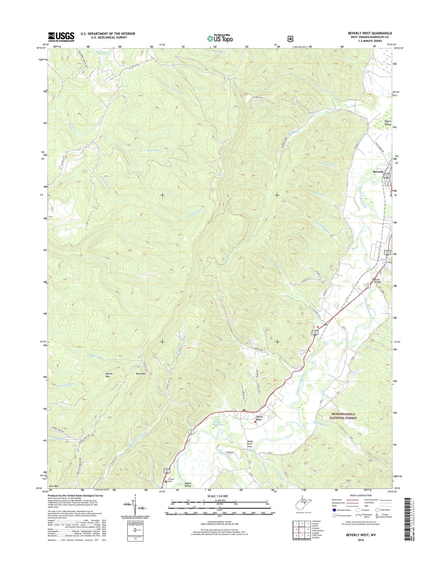
2019 topographic map quadrangle Beverly West in the state of West Virginia. Scale: 1:24000. Based on the newly updated USGS 7.5' US Topo map series, this map is in the following counties: Randolph. The map contains contour data, water features, and other items you are used to seeing on USGS maps, but also has updated roads and other features. This is the next generation of topographic maps. Printed on high-quality waterproof paper with UV fade-resistant inks.
Quads adjacent to this one:
West: Cassity
Northwest: Ellamore
North: Junior
Northeast: Elkins
East: Beverly East
Southeast: Wildell
South: Mill Creek
Southwest: Adolph
Contains the following named places: Beverly, Beverly Historic District, Burnt Bridge, Cassity Run, Coverly Run, Crawford Run, Crawford School, Crouch Cemetery, Dailey, Dailey Census Designated Place, Dailey Post Office, East Dailey, East Dailey Census Designated Place, Files Creek, Glade Run School, Harper Run, Harrison Church, Homestead Elementary School, Jones Run, Light Run, Lonetree, Nettle Mountain, Randolph County, Rich Mountain Fire Lookout Tower, Rich Mountain Lookout Tower, Scott Lake, Sea Run, Shavers Run, Stalnaker Run, Steiner, Troutwine Run, Tygart Valley Fire Company Station 1, Tygart Valley Fire Company Station 2, Valley Bend, Valley Bend Census Designated Place, Valley Bend Church, Valley Bend Post Office, Valley Bend Truss, Valley Bend Wetland, Valley Bend Wetland Wildlife Management Area, Ward Run, Whites School, Wilson School, Wood Run, ZIP Codes: 26259, 26293