MyTopo
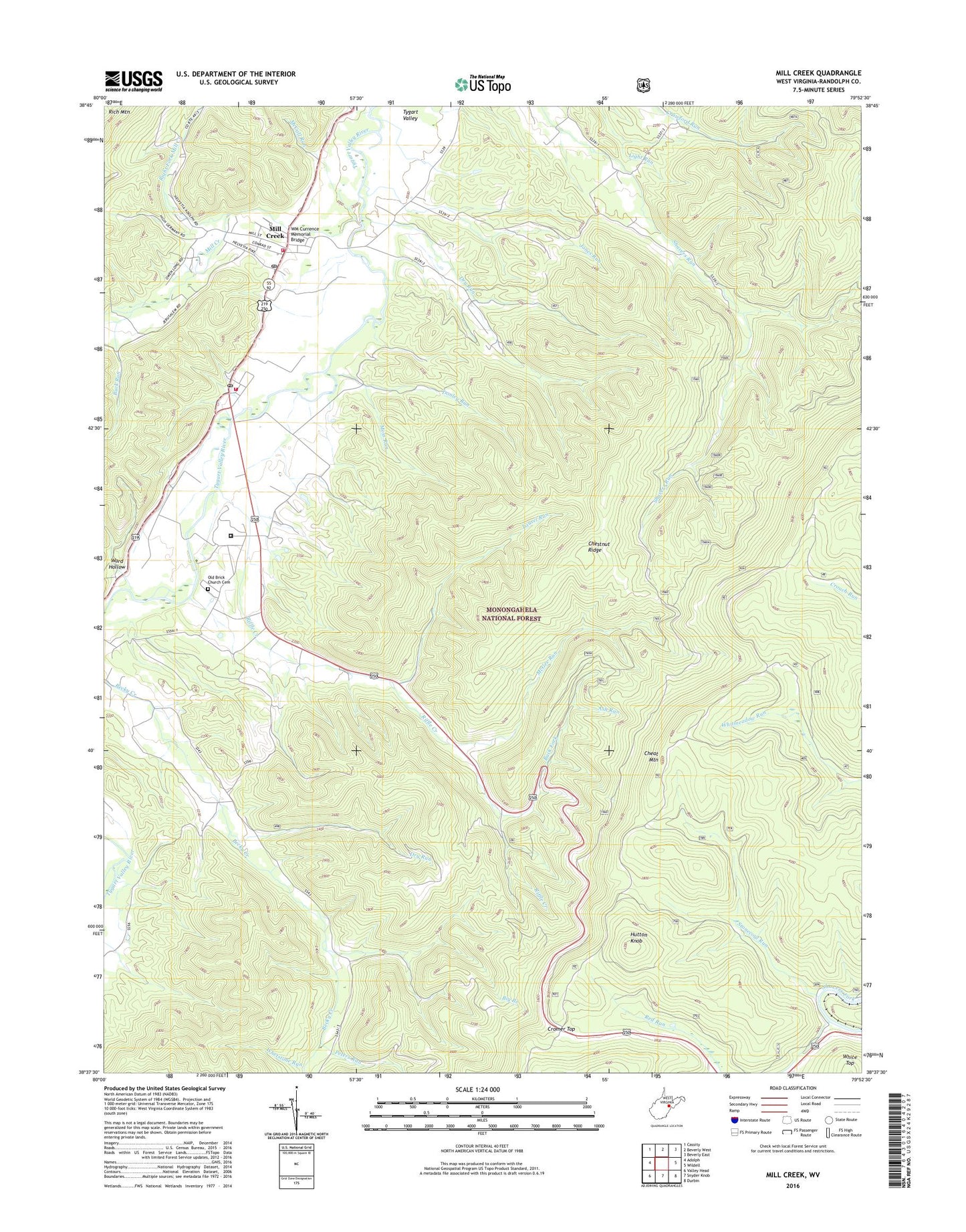
Mill Creek West Virginia US Topo Map
Couldn't load pickup availability
Also explore the Mill Creek Forest Service Topo of this same quad for updated USFS data
2023 topographic map quadrangle Mill Creek in the state of West Virginia. Scale: 1:24000. Based on the newly updated USGS 7.5' US Topo map series, this map is in the following counties: Randolph. The map contains contour data, water features, and other items you are used to seeing on USGS maps, but also has updated roads and other features. This is the next generation of topographic maps. Printed on high-quality waterproof paper with UV fade-resistant inks.
Quads adjacent to this one:
West: Adolph
Northwest: Cassity
North: Beverly West
Northeast: Beverly East
East: Wildell
Southeast: Durbin
South: Snyder Knob
Southwest: Valley Head
This map covers the same area as the classic USGS quad with code o38079f8.
Contains the following named places: Ash Run, Back Fork, Big Branch, Buck Run, Channel School, Cheat Wildlife Management Area, Chestnut Ridge, Chestnut Ridge Trail, Cromer Top, Donley Run, Donley Run School, Dry Run, Dry Run School, Edwards Chapel, George Ward Elementary School, Hutton Knob, Huttonsville, Huttonsville - Mill Creek Volunteer Fire Department Station 1, Huttonsville - Mill Creek Volunteer Fire Department Station 2, Huttonsville Correctional Center, Huttonsville District, Huttonsville Post Office, Huttonsville State Farm Wildlife Management Area, Jerusalem Church, Jones Run, Laurel Run, Laurel Run Trail, Lee Bell School, McCall Run, McGee Run, McGee Run Trail, Mill Creek, Mill Creek Post Office, Moss Run, Old Brick Church Cemetery, Peters Run, Randolph County Emergency Squad Station 2, Red Run, Riffle Creek, Riffle Creek School, Right Fork Mill Creek, Rosenkrantz School, Shavers Run School, Stonecoal Hunter Access Trail, Stonecoal Run, Town of Huttonsville, Town of Mill Creek, Tygart Valley Church, Tygart Valley Public Library, Tygarts Valley Middle and High School, Ward Hollow, Whetstone Run, WM Currence Memorial Bridge