MyTopo
Diana West Virginia US Topo Map
Couldn't load pickup availability
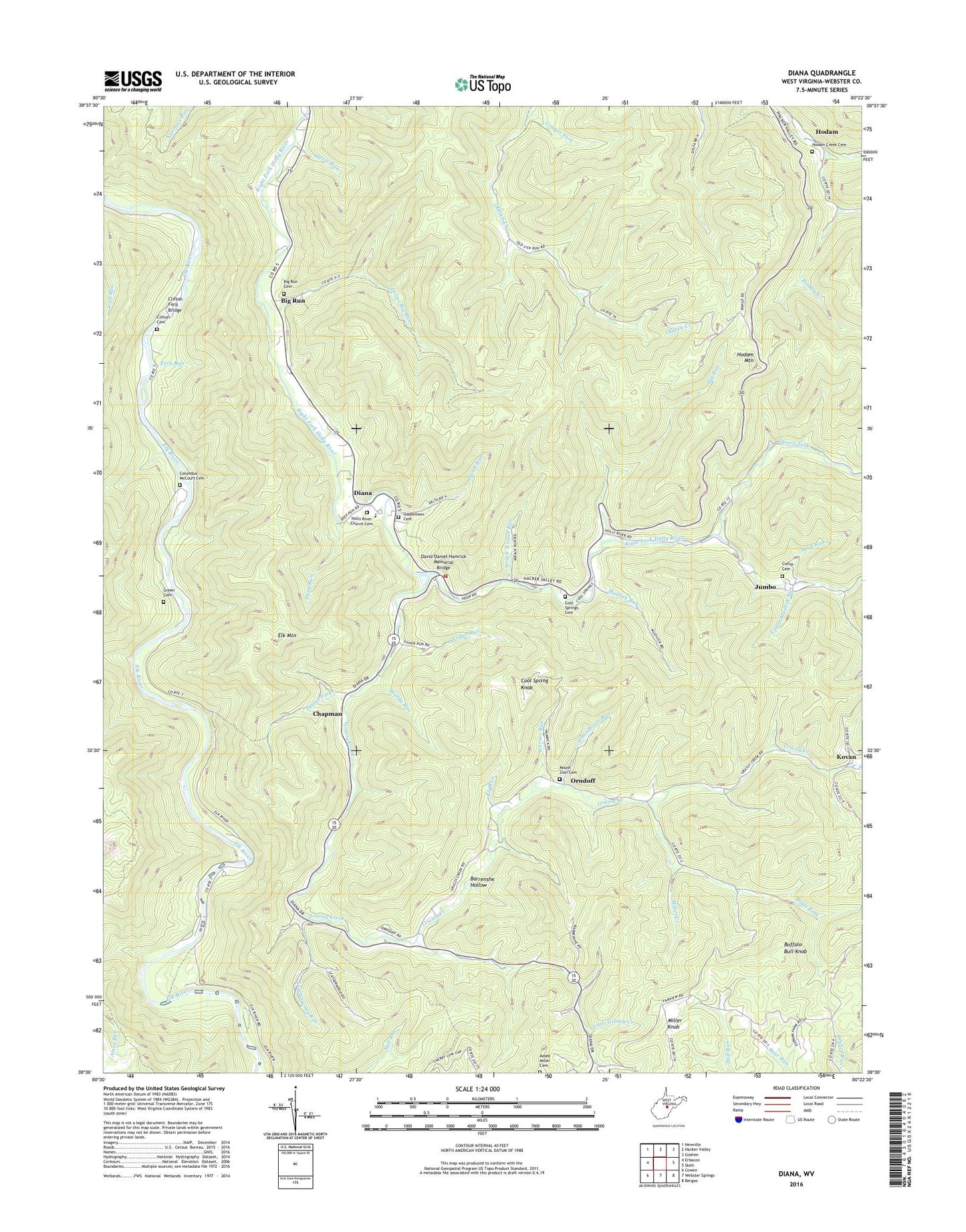
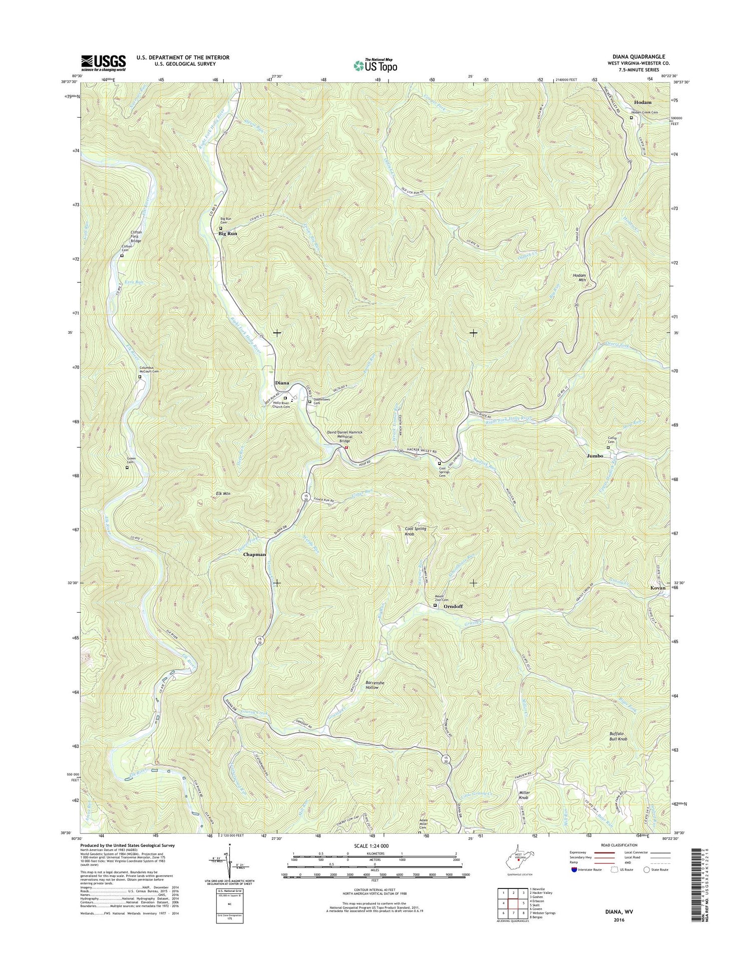
2019 topographic map quadrangle Diana in the state of West Virginia. Scale: 1:24000. Based on the newly updated USGS 7.5' US Topo map series, this map is in the following counties: Webster. The map contains contour data, water features, and other items you are used to seeing on USGS maps, but also has updated roads and other features. This is the next generation of topographic maps. Printed on high-quality waterproof paper with UV fade-resistant inks.
Quads adjacent to this one:
West: Erbacon
Northwest: Newville
North: Hacker Valley
Northeast: Goshen
East: Skelt
Southeast: Bergoo
South: Webster Springs
Southwest: Cowen
Contains the following named places: Adam Miller Cemetery, Barrenshe Hollow, Bethany Church, Big Lick Fork, Big Run, Big Run Cemetery, Blaze Fork, Buffalo Bull Knob, Chapman, Clifton Cemetery, Clifton Ford, Clifton Ford Bridge, Columbus McCourt Cemetery, Cool Spring Knob, Cool Spring School, Cool Springs Cemetery, Cougar Fork, Cutlip Cemetery, David Daniel Hamrick Memorial Bridge, Deep Run, Desert Fork, Diana, Diana Elementary School, Diana Post Office, Diana Volunteer Fire Department, Elk Mountain, Enoch Run, Ezra Run, Fisher Run, Grassy Creek, Green Cemetery, Gregory School, Hodam, Hodam Creek Cemetery, Hodam Mountain, Holly River Baptist Church Cemetery, Holly River Church, Jumbo, Kovan, Laurel Fork, Laurel Mountain Church, Leatherwood Run, Little Grassy Creek, Lower Big Run, McCourt Ford, Miller Creek, Miller Knob, Mount Zion Cemetery, Mount Zion Church, Mountain View Golf Course, Mudlick Run, Odd Fellows Cemetery, Orndoff, Orndoff Church, Orndoff School, Schoolhouse Run, Shop Run, Snuffville School, Summit, Union Valley Church, Upper Mudlick Run, Warner Run, Weedy Run, Weese Run, Wrack Timber Run, ZIP Code: 26217