MyTopo
Hacker Valley West Virginia US Topo Map
Couldn't load pickup availability
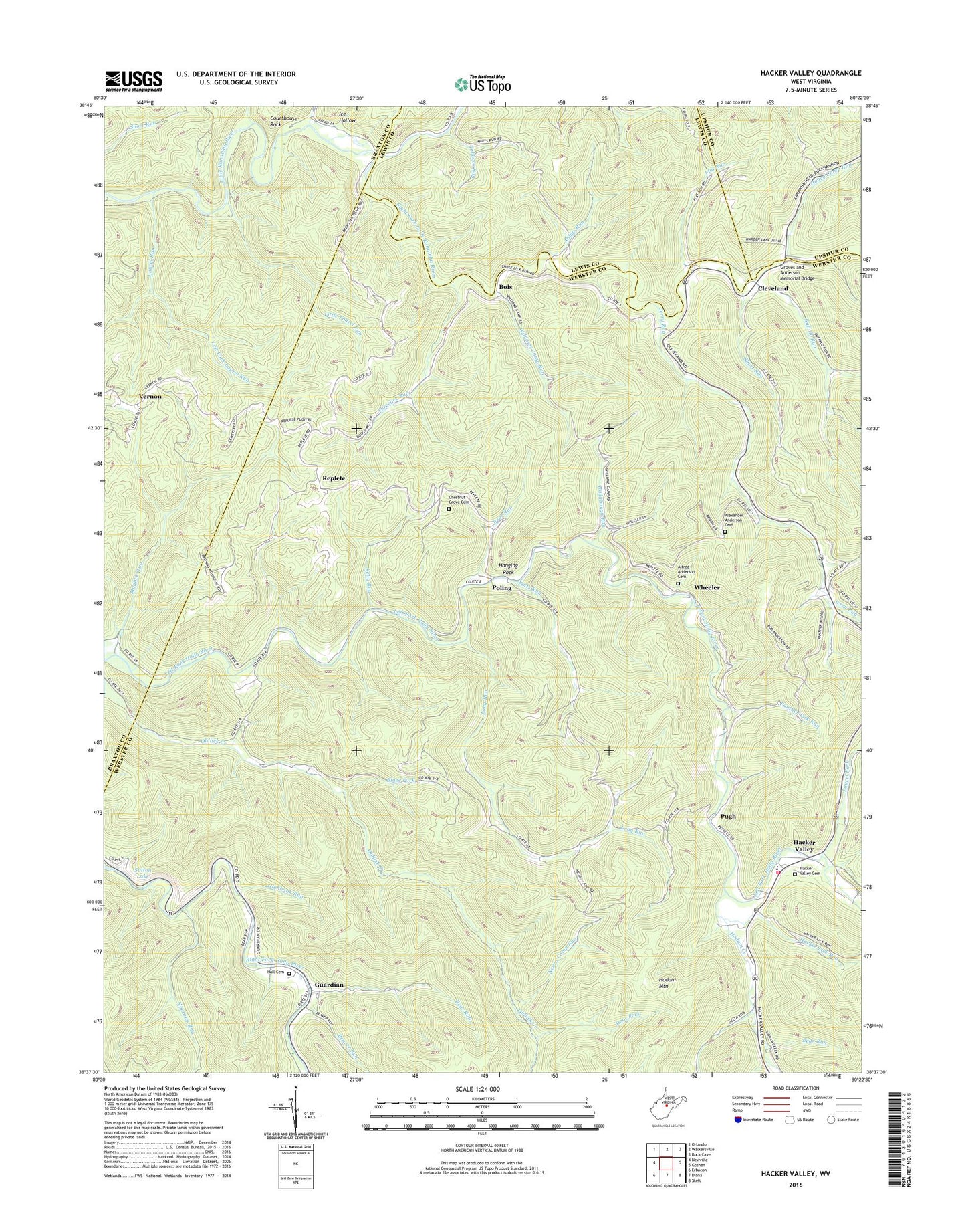
2023 topographic map quadrangle Hacker Valley in the state of West Virginia. Scale: 1:24000. Based on the newly updated USGS 7.5' US Topo map series, this map is in the following counties: Webster, Braxton, Lewis, Upshur. The map contains contour data, water features, and other items you are used to seeing on USGS maps, but also has updated roads and other features. This is the next generation of topographic maps. Printed on high-quality waterproof paper with UV fade-resistant inks.
Quads adjacent to this one:
West: Newville
Northwest: Orlando
North: Walkersville
Northeast: Rock Cave
East: Goshen
Southeast: Skelt
South: Diana
Southwest: Erbacon
This map covers the same area as the classic USGS quad with code o38080f4.
Contains the following named places: Alexander Anderson Cemetery, Alfred Anderson Cemetery, Amos Fork, Andys Run, Bear Run, Beaver Run, Beulah School, Blaze Fork, Bois, Buffalo Run, Buffalo School, Chestnut Grove Cemetery, Chestnut Grove Church, Chestnut Grove School, Cleveland, Courthouse Rock, Cowger Hill Church, Dry Run, Fishers Crossing, Flat Run, Groves and Anderson Memorial Bridge, Guardian, Hacker Lick Run, Hacker Valley, Hacker Valley Cemetery, Hacker Valley Church, Hacker Valley Elementary School, Hacker Valley Post Office, Hacker Valley Volunteer Fire Department, Hall Cemetery, Hanging Rock, Highbank Run, Hodam Creek, Honey Camp Run, Ice Hollow, Jerry Run, Kelly Run, Laurel Fork, Laurel Run, Left Fork Laurel Run, Little Laurel Run, Long Run, Mudlick Run, Narrows Run, Negro Camp Run, Panther Lick Church, Panther Lick Run, Papaw Run, Pleasant View School, Poling, Potts Run, Pretty Run, Pugh, Radabaugh Run, Replete, Right Fork Little Kanawha River, Saffles Retreat School, Short Run, Threelick Run, Tobacco Run, Vernon, Wheeler, Wildcat, Williams Camp Run, Williams Camp School