MyTopo
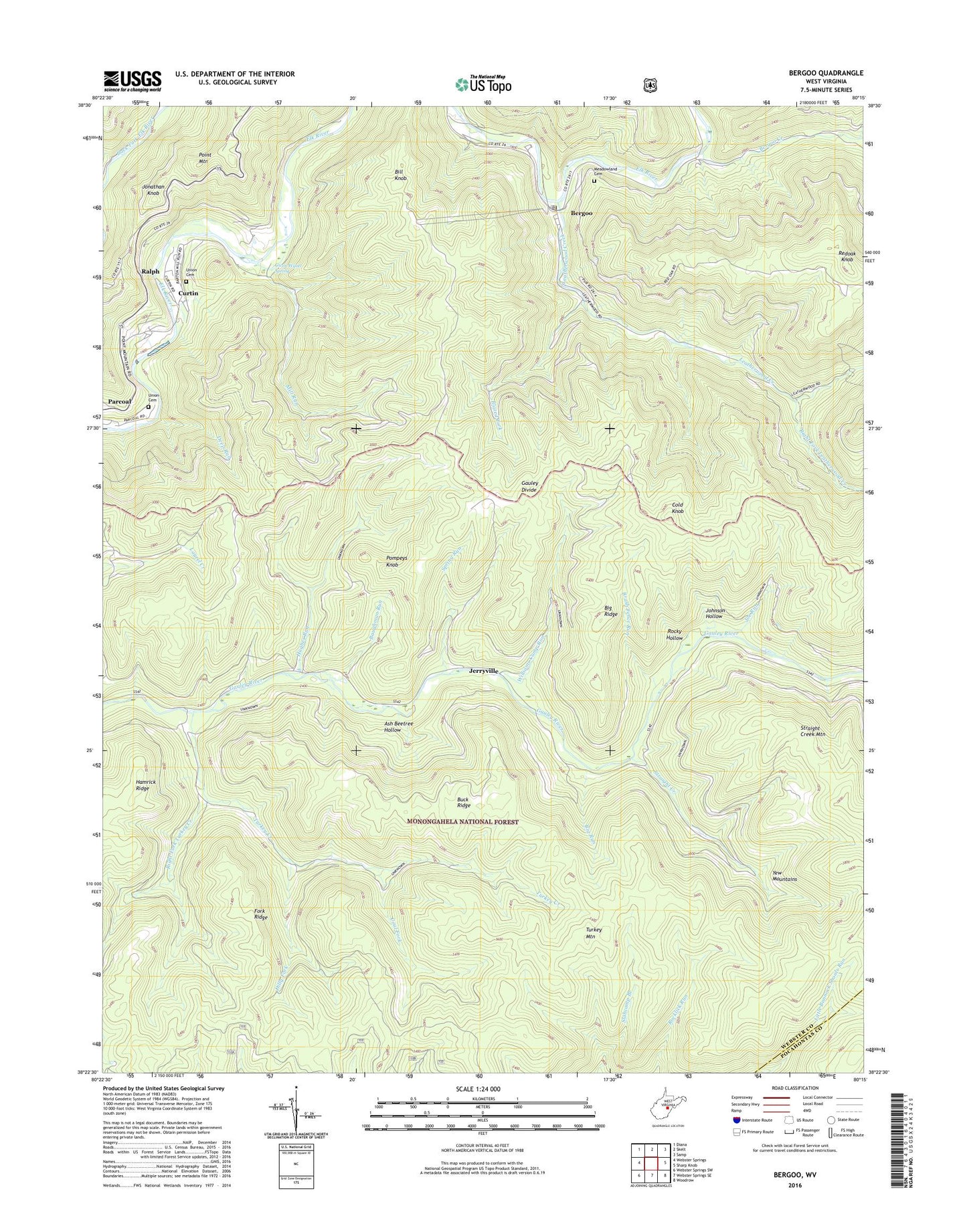
Bergoo West Virginia US Topo Map
Couldn't load pickup availability
Also explore the Bergoo Forest Service Topo of this same quad for updated USFS data
2023 topographic map quadrangle Bergoo in the state of West Virginia. Scale: 1:24000. Based on the newly updated USGS 7.5' US Topo map series, this map is in the following counties: Webster, Pocahontas. The map contains contour data, water features, and other items you are used to seeing on USGS maps, but also has updated roads and other features. This is the next generation of topographic maps. Printed on high-quality waterproof paper with UV fade-resistant inks.
Quads adjacent to this one:
West: Webster Springs
Northwest: Diana
North: Skelt
Northeast: Samp
East: Sharp Knob
Southeast: Woodrow
South: Webster Springs SE
Southwest: Webster Springs SW
This map covers the same area as the classic USGS quad with code o38080d3.
Contains the following named places: Ash Beetree Hollow, Baughman Run, Bergoo, Bergoo Census Designated Place, Bergoo Creek, Bergoo Post Office, Big Ridge, Big Run, Bill Knob, Bill Knob School, Blazed Fork, Brush Fence Run, Buck Ridge, Coal Fork, Cold Knob, Curtin, Curtin Census Designated Place, Deep Run, Dilly Fork, Drybed Run, Fork Ridge, Gwen Wyatt Spring, Hughes Run, Hughes Run School, Jerryville, Joe Run, Johnson Hollow, Jonathan Knob, Leatherwood Creek, Meadowland Cemetery, Mill Run, Mill Run School, Parcoal, Parcoal Census Designated Place, Pleasant Grove Church, Pompeys Knob, Ralph, Redoak Knob, Redoak School, Right Fork Leatherwood Creek, Right Fork Turkey Creek, Rocky Hollow, Saint Marys School, Spring Run, Straight Creek, Straight Creek Mountain, Turkey Creek, Turkey Mountain Trail, Twin Branch Trail, Union Cemetery, Williams Camp Run, ZIP Code: 26298