
MyTopo
Goshen West Virginia US Topo Map
Couldn't load pickup availability
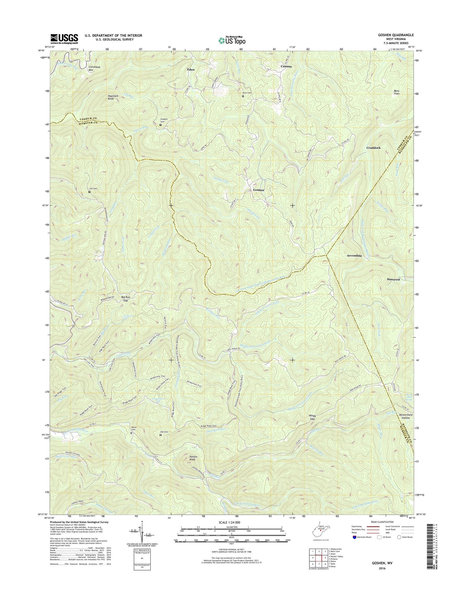
2019 topographic map quadrangle Goshen in the state of West Virginia. Scale: 1:24000. Based on the newly updated USGS 7.5' US Topo map series, this map is in the following counties: Webster, Upshur, Randolph. The map contains contour data, water features, and other items you are used to seeing on USGS maps, but also has updated roads and other features. This is the next generation of topographic maps. Printed on high-quality waterproof paper with UV fade-resistant inks.
Quads adjacent to this one:
West: Hacker Valley
Northwest: Walkersville
North: Rock Cave
Northeast: Alton
East: Pickens
Southeast: Samp
South: Skelt
Southwest: Diana
Contains the following named places: Arvondale, Bee Run, Bens Flats, Big Lick Run, Big Run, Big Run Gap, Birchpen Run, Canaan, Cleveland Mountain, Conrad Fork, Craddock, Crooked Fork, Devil Fork, Eden, Edward T Balli Spring, Fall Run, Goshen, Goshen Church, Gregory Cemetery, Haystack Knob, Hell Run, High Rock Trail, Holly River State Park, Howell Fork, Johns Run, Left Fork Laurel Fork, Left Fork Right Fork Little Kanawha River, Life Cemetery, Long Run, Long Run Church, Mader Run, Mayton, Middle Fork Laurel Fork, New Mayton School, Old Cemetery, Painter Run, Penbro, Pleasant Hill Church, Potato Knob, Reverie Trail, Rice Cemetery, Right Fork Laurel Fork, Rockcamp Run, Salt Lick Trail, Slab Camp Run, Snake Run, Spruce Fork, Spruce Run, Suncrest, Tater Knob Run, Tecumseh Falls, Tenskwatawa Falls, Tramontane Trail, Turkey Fork, Vance Cemetery, Vance School, Wilderness Trail, Windy Gap, Windy Gap School, Winterfield Hollow, ZIP Codes: 26215, 26222


