MyTopo
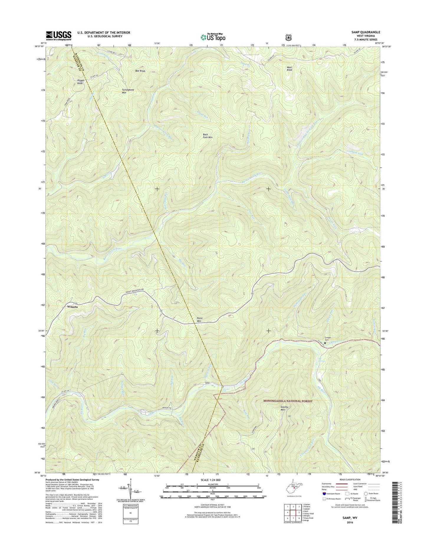
Samp West Virginia US Topo Map
Couldn't load pickup availability
Also explore the Samp Forest Service Topo of this same quad for updated USFS data
2023 topographic map quadrangle Samp in the state of West Virginia. Scale: 1:24000. Based on the newly updated USGS 7.5' US Topo map series, this map is in the following counties: Randolph, Webster. The map contains contour data, water features, and other items you are used to seeing on USGS maps, but also has updated roads and other features. This is the next generation of topographic maps. Printed on high-quality waterproof paper with UV fade-resistant inks.
Quads adjacent to this one:
West: Skelt
Northwest: Goshen
North: Pickens
Northeast: Adolph
East: Valley Head
Southeast: Mingo
South: Sharp Knob
Southwest: Bergoo
This map covers the same area as the classic USGS quad with code o38080e2.
Contains the following named places: Anderson Camp Run, Back Fork Mountain, Bee Knob, Big Run, Chimney Rock Run, Coalbank Fork, Cowger Cemetery, Elk Spring, Flint Run, Hamrick Run, Hewett Fork, Hickorylick Run, Hull Camp Run, Left Fork Back Fork Elk River, Little Run, Mast Knob, Middlebrook, Mill Run, Mitchell Run, Morgan School, Parting Springs, Parting Springs Lookout Tower, Pisgah Knob, Point Mountain, Redlick Run, Rose Run, Rough Run, Samp, Thayer Run, Turkeybone School, Upper Elk School, Upper Flint Run, Upper Point Mountain School, Valley Fork, Waneta, Whitaker Falls, Wolfpen Run, ZIP Code: 26282