MyTopo
Harman West Virginia US Topo Map
Couldn't load pickup availability
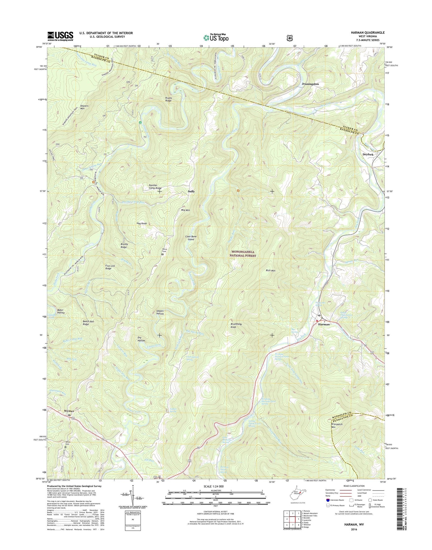
2019 topographic map quadrangle Harman in the state of West Virginia. Scale: 1:24000. Based on the newly updated USGS 7.5' US Topo map series, this map is in the following counties: Randolph, Tucker, Pendleton. The map contains contour data, water features, and other items you are used to seeing on USGS maps, but also has updated roads and other features. This is the next generation of topographic maps. Printed on high-quality waterproof paper with UV fade-resistant inks.
Quads adjacent to this one:
West: Bowden
Northwest: Parsons
North: Mozark Mountain
Northeast: Blackwater Falls
East: Laneville
Southeast: Onego
South: Whitmer
Southwest: Glady
Contains the following named places: Ash Lick, Baker Hollow, Beech Pen Ridge, Big Run, Big Spring, Big Spring Run, Birch Lick, Brierpatch Mountain, Brushheap Knob, Brushy Creek, Brushy Ridge, Coon Bone Island, Coopers Run, Cunningham Spring, Dr Bucher Spring, Dry Hollow, Dryfork, Five Lick Creek, Five Lick Ridge, Flannigan School, George Tyson Farm Spring, Harman, Harman Church of the Brethren, Harman Post Office, Harman School, Harman Volunteer Fire Department, Hazelwood, Herman Smith Spring, Hog Knob, Hog Run, Horsecamp Run, Jasper Yokum Farm Springs, Jenningston, Job Run, John Mullennex Spring, Johnson School, Kerns Cemetery, Krafts Ridge, Kuntzville, Laurel Fork, Little Tory Camp Run, Mylius School, Panther Camp Ridge, Panther Camp Run, Pennington School, Perlytown, Pershing Harman Farm Spring, Pioneer Memorial Public Library, Randolph County Emergency Squad Station 3, Red Creek, Red Creek Junction, Rich Mountain, Rich Mountain School, Riverside Church, Shears Hollow, Snyder Run, Spruce Run, Suck Lick Run, Sully, Taylor Elza Run, Three Spring Run, Tory Camp Run, Town of Harman, Two Spring Run, White Cemetery, Wymer, Wymer Post Office, Yankee Spring